Portal:Derbyshire/Selected article/4

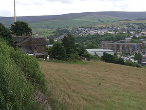
Glossop is a small market town within the High Peak borough of Derbyshire. It lies on the Glossop Brook, a tributary of the River Etherow, about 14 miles (23 km) east of Manchester, 24 miles (39 km) west of Sheffield and 30 miles (48.3 km) from Matlock. Glossop is situated near Derbyshire's county borders with Cheshire, Greater Manchester, South Yorkshire and West Yorkshire. It is between 150 and 300 metres (492 and 984 ft) above mean sea level, and uses the tagline "the gateway to the Peak District National Park". Like Buxton, it differs from other areas of the borough in that it is an unparished area, and this distinction defines its boundaries. It had a total population of over 32,000 in 2001.
Historically the name Glossop refers to the small hamlet that gave its name to an ancient parish recorded in the Domesday Book of 1086 ...
