Jump to content

Tskhemliskhidi

Coordinates: 41°55′33″N 42°05′03″E / 41.92583°N 42.08417°E / 41.92583; 42.08417
From Wikipedia, the free encyclopedia

This is the current revision of this page, as edited by GiorgiXIII (talk | contribs) at 11:51, 16 June 2022. The present address (URL) is a permanent link to this version.

(diff) ← Previous revision | Latest revision (diff) | Newer revision → (diff)
Tskhemliskhidi
ცხემლისხიდი
Village
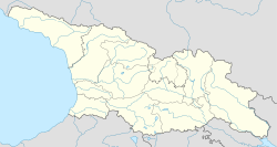
Tskhemliskhidi is located in Georgia
Tskhemliskhidi
Tskhemliskhidi
Location of Tskhemliskhidi in Georgia
Tskhemliskhidi is located in Guria
Tskhemliskhidi
Tskhemliskhidi
Tskhemliskhidi (Guria)
Coordinates: 41°55′33″N 42°05′03″E / 41.92583°N 42.08417°E / 41.92583; 42.08417
Country Georgia
MkhareGuria
MunicipalityOzurgeti
Elevation
90 m (300 ft)
Population
 (2014)
 • Total446
Time zoneUTC+4 (Georgian Time)

Tskhemliskhidi (Georgian: ცხემლისხიდი) is a village in the Ozurgeti Municipality of Guria in western Georgia.[1]

References

[edit]
  1. ^ Georgian Soviet Encyclopedia Vol. 11, p. 250, 1987.