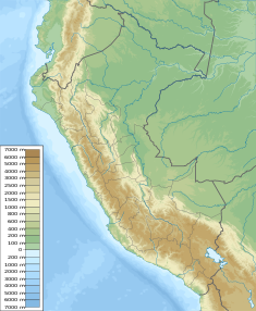
Huascacocha (Carhuacayan)
Appearance
| Huascacocha | |||||||||
|---|---|---|---|---|---|---|---|---|---|
| Location | Peru Junín Region | ||||||||
| Coordinates | 11°05′22″S 76°24′44″W / 11.08944°S 76.41222°W | ||||||||
| Max. length | 5.10 km (3.17 mi) | ||||||||
| Max. width | 0.95 km (0.59 mi) | ||||||||
| Surface elevation | 4,484 m (14,711 ft) | ||||||||
| |||||||||
Huascacocha (possibly from Quechua waskha (also waska) rope, qucha lake,[1]) is a lake in Peru located in the Junín Region, Yauli Province, Carhuacayan District.[2] It is situated at a height of approximately 4,484 m (14,711 ft), about 5.10 km long and 0.95 km at its widest point.
In 2012 the Huascacocha dam was inaugurated.[3] The dam lies was erected at the southeastern end of the lake.
See also
[edit]References
[edit]- ^ Teofilo Laime Ajacopa (2007). Diccionario Bilingüe: Iskay simipi yuyayk’anch: Quechua – Castellano / Castellano – Quechua (PDF). La Paz, Bolivia: futatraw.ourproject.org.
- ^ escale.minedu.gob.pe - UGEL map of the Yauli Province (Junín Region)
- ^ "Presidente Humala inauguró represa de Huascacocha que garantizará suministro de agua a 2.5 millones de limeños". presidencia.gob.pe. Archived from the original on March 4, 2016. Retrieved December 31, 2015.
- INEI, Compendio Estadistica 2007, page 26


