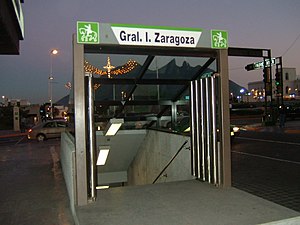
General I. Zaragoza metro station
Appearance
General I. Zaragoza | ||||||||||||||||
|---|---|---|---|---|---|---|---|---|---|---|---|---|---|---|---|---|
 | ||||||||||||||||
| General information | ||||||||||||||||
| Location | Monterrey Nuevo León, Mexico | |||||||||||||||
| Coordinates | 25°40′04″N 100°18′37″W / 25.66778°N 100.31028°W | |||||||||||||||
| Operated by | STC Metrorrey | |||||||||||||||
| History | ||||||||||||||||
| Opened | 30 November 1994[1] | |||||||||||||||
| Services | ||||||||||||||||
| ||||||||||||||||
General I. Zaragoza (Template:Lang-es or Terminal Zaragoza) is a station on Lines 2 and 3 of the Monterrey Metro. It is located in Monterrey, on the heart of the Macroplaza. The station was opened on 30 November 1994 as the eastern terminus of the inaugural section of Line 2, between General Anaya and Zaragoza.[2][1]
This station serves the heart of the Monterrey shopping district. It is one block away from Morelos Street, and Monterrey's Zona Rosa, MARCO museum and the Monterrey City Hall. It is accessible for people with disabilities.
It is named after General Ignacio Zaragoza and the nearby Avenida Ignacio Zaragoza. The station logo depicts this Mexican military genius – the hero of the Battle of Puebla – astride his horse.
See also
References
- ^ a b "STC Metrorrey - Gobierno del Estado de Nuevo León, México: HISTORIA" (in Spanish). Retrieved July 13, 2011.
- ^ Schwandl, Robert. "Monterrey". urbanrail.
