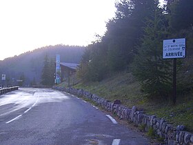
Col Saint Martin
Appearance
| Col Martin | |
|---|---|
 | |
| Elevation | 1,500 m (4,921 ft) |
| Traversed by | D 2205 |
| Location | Alpes-Maritimes, France |
| Range | Alps |
| Coordinates | 44°4′16″N 7°13′15″E / 44.07111°N 7.22083°E |
Col Saint Martin (el. 1500 m.) is a high mountain pass in the Alps in the department of Alpes-Maritimes in France.[1]
It is traversed by the D-2205 highway.[2]
The place has been crossed at the Tour de France road cycling race in 1973, 1975 and 2020, as well as at multiple editions of the Paris-Nice.
See also
[edit]References
[edit]- ^ "Col Saint Martin, an iconic road in the Alpes-Maritimes". www.dangerousroads.org. Retrieved 2022-05-13.
- ^ "Col Saint-Martin depuis D2205 : 1503m". www.cols-cyclisme.com (in French). Retrieved 2022-05-13.
