Goczałkowice Lake
Appearance
| Goczałkowice Lake | |
|---|---|
| Jezioro Goczałkowickie (Polish) | |
 Aerial view of Goczałkowice Reservoir | |
| Location | Silesian Voivodeship, Poland |
| Coordinates | 49°55′48.03″N 18°51′43.75″E / 49.9300083°N 18.8621528°E |
| Type | Reservoir |
| River sources | Vistula |
| Built | 1956 |
| Surface area | 32 km2 (12 sq mi) |
| Water volume | 168,000,000 m3 (5.9×10⁹ cu ft) |
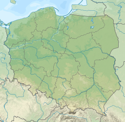
Goczałkowice Lake (Polish: Jezioro Goczałkowickie) is an artificial water reservoir close to Goczałkowice-Zdrój in the Silesian Voivodeship in Poland created with a dam on the Vistula in 1956. The area of the reservoir is 32 square kilometres and its capacity is 168 million m³. It is around 75 kilometres west of Kraków.
The shores of the lake are the breeding area for many bird species.
Wikimedia Commons has media related to Goczałkowice Lake.

