Lenger
Appearance
Lenger | |
|---|---|
| Coordinates: 42°10′55″N 69°53′16″E / 42.18194°N 69.88778°E | |
| Country | Kazakhstan |
| Region | Turkistan |
| Area | |
| • Total | 2,047 km2 (790 sq mi) |
| Population (2012) | |
| • Total | 25,298 |
| Time zone | UTC+6 (UTC+6) |
| Climate | Dsa |
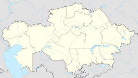
Lenger (Template:Lang-kk, Leñgır,لەڭگىر; Template:Lang-ru) is a city in Tole Bi District, Turkistan Region of Kazakhstan. As of 2012 Lenger had a population of 25,298.[1] Lenger is the administrative center of the Tole Bi District. The Museum of the Tole Bi District (Музей Толебийского района) is in Lenger.[2] Population: 24,642 (2009 Census results);[3] 22,038 (1999 Census results).[3]
Etymology
From Persian language it means "Caravan station" or "Sufi almhouse"
In popular culture
- In Command & Conquer: Generals, Lenger serves as a traitorous GLA warlord's base serving Chinese "masters". GLA forces loyal to the Commander were commanded to destroy both traitors and repulse any Chinese allies' attempts to relief the attack.[4]
References
- ^ http://www.stat.kz Archived 2010-03-14 at the Wayback Machine
- ^ "«Музей Толебийского района» ГККП | Управление культуры". Archived from the original on 2015-04-02. Retrieved 2013-02-18.
- ^ a b "Население Республики Казахстан" [Population of the Republic of Kazakhstan] (in Russian). Департамент социальной и демографической статистики. Retrieved 8 December 2013.
- ^ Archived at Ghostarchive and the Wayback Machine: Command And Conquer Generals - GLA Mission 6. YouTube.


