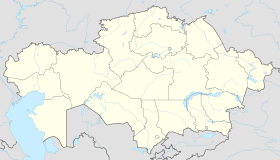
Ertis, Pavlodar Region
Appearance
Ertis
Ертіс | |
|---|---|
| Coordinates: 53°20′00″N 75°27′26″E / 53.33333°N 75.45722°E | |
| Country | Kazakhstan |
| Region | Pavlodar Region |
| District | Ertis District |
| Population (2019) | |
| • Total | 7,072 |
| Time zone | UTC+6 (UTC+6) |
| Climate | Dfb |
Ertis (Kazakh: Ертіс, Ertıs) is a village in northern Kazakhstan. It is the administrative center of Ertis District in Pavlodar Region. Population: 7,772 (2009 Census results).[1]
Geography
Ertis is situated on the left bank of the Irtysh River.[2][3]
Climate
| Climate data for Ertis (1991–2020, extremes 1936–present) | |||||||||||||
|---|---|---|---|---|---|---|---|---|---|---|---|---|---|
| Month | Jan | Feb | Mar | Apr | May | Jun | Jul | Aug | Sep | Oct | Nov | Dec | Year |
| Record high °C (°F) | 2.8 (37.0) |
5.1 (41.2) |
20.3 (68.5) |
32.8 (91.0) |
37.8 (100.0) |
40.7 (105.3) |
41.8 (107.2) |
39.1 (102.4) |
37.3 (99.1) |
28.9 (84.0) |
16.6 (61.9) |
3.8 (38.8) |
41.8 (107.2) |
| Mean daily maximum °C (°F) | −12.9 (8.8) |
−10.7 (12.7) |
−2.6 (27.3) |
11.7 (53.1) |
20.4 (68.7) |
25.3 (77.5) |
26.5 (79.7) |
24.4 (75.9) |
17.7 (63.9) |
9.4 (48.9) |
−2.4 (27.7) |
−9.7 (14.5) |
8.1 (46.6) |
| Daily mean °C (°F) | −17.2 (1.0) |
−15.2 (4.6) |
−7.1 (19.2) |
5.9 (42.6) |
14.1 (57.4) |
19.5 (67.1) |
20.9 (69.6) |
18.5 (65.3) |
11.8 (53.2) |
4.4 (39.9) |
−6.3 (20.7) |
−13.8 (7.2) |
3.0 (37.4) |
| Mean daily minimum °C (°F) | −21.6 (−6.9) |
−19.8 (−3.6) |
−11.8 (10.8) |
0.3 (32.5) |
7.2 (45.0) |
13.3 (55.9) |
15.1 (59.2) |
12.5 (54.5) |
6.3 (43.3) |
−0.1 (31.8) |
−9.9 (14.2) |
−18.1 (−0.6) |
−2.2 (28.0) |
| Record low °C (°F) | −45.6 (−50.1) |
−43.7 (−46.7) |
−38.7 (−37.7) |
−25.0 (−13.0) |
−9.9 (14.2) |
−1.3 (29.7) |
4.8 (40.6) |
−1.9 (28.6) |
−7.0 (19.4) |
−20.0 (−4.0) |
−40.7 (−41.3) |
−44.6 (−48.3) |
−45.6 (−50.1) |
| Average precipitation mm (inches) | 11 (0.4) |
12 (0.5) |
12 (0.5) |
20 (0.8) |
24 (0.9) |
40 (1.6) |
53 (2.1) |
39 (1.5) |
20 (0.8) |
24 (0.9) |
18 (0.7) |
17 (0.7) |
290 (11.4) |
| Source: Pogoda.ru.net[4] | |||||||||||||
References
- ^ "Население Республики Казахстан" [Population of the Republic of Kazakhstan] (in Russian). Департамент социальной и демографической статистики. Retrieved 8 December 2013.
- ^ "N-43 Topographic Chart (in Russian)". Retrieved 12 March 2024.
- ^ Google Earth.
- ^ "Климат Иртышск" (in Russian). Погода и Климат. Retrieved January 3, 2022.


