Garbahare
This article needs additional citations for verification. (May 2017) |
This article possibly contains original research. (October 2019) |
Garbaharey
Garbiharey | |
|---|---|
City | |
| Nickname: Garbo | |
| Motto: "Gacmo wadajir bay wax ku gooyaan" | |
| Coordinates: 3°21′N 42°16′E / 3.350°N 42.267°E | |
| Country | |
| State | |
| Region | Gedo |
| Government | |
| Population (2015) | |
| • Total | 286,324 |
| Time zone | UTC+3 (East Africa Time) |
| Area code | +252 |
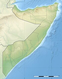
Garbahare (also: Garbaharey) (Somali: Garbaharey, Maay: Garbiharey, Arabic: جربهاري) is the capital of Gedo, an administrative region in southern Somalia. It is the third largest and most populous city in the Gedo region after Bardera and Luuq.[1]
History
During the Middle Ages, Garbahare and its surrounding area were part of the Ajuran Empire that governed much of southern Somalia and eastern Ethiopia, with its domain extending from Hobyo in the north, to Qelafo in the west, to Kismayo in the south.[2]
In the early modern period, the Garbahare area was ruled by the Geledi Sultanate. The kingdom was eventually incorporated into the Italian Somaliland protectorate in 1910 after the death of its last Sultan Osman Ahmed in 1910.[3] After independence in 1960, the city became the capital of Gedo region.
Insecurity of the 1990s
During much of the 1990s, the city of Garbahare was the seat of the Somali National Front militia in the early days of the civil war. Facing pressure from the local population, the militia left.
By early 2001, Garbahare came under the control of the Transitional National Government.[4] All activities shifted to Luuq and Beled Haawo, and Garbahare had a new role in the region. Neighboring regions such as NFD welcomed the new leadership, as a safer Gedo is also good for the neighboring regions in Kenya and Ethiopia.
During the 2009 phase of the civil war, al-Shabaab militants captured the city, but were pushed out in 2011 by government forces commanded by Nur Matan Abdi.[5]
See also
Notes
- ^ Jones, Seth (2016). Counterterrorism and Counterinsurgency in Somalia Assessing the Campaign Against Al Shabaab. RAND corporation. p. 44. ISBN 9780833094841.
- ^ Lee V. Cassanelli, The shaping of Somali society: reconstructing the history of a pastoral people, 1600-1900, (University of Pennsylvania Press: 1982), p.102.
- ^ Cassanelli, Lee Vincent (1973). The Benaadir Past: Essays in Southern Somali History. University Microfilms International. p. 149.
- ^ "Horn of Africa, Monthly Review, January - February 2001" Archived 2010-12-18 at the Wayback Machine (accessed 24 February 2009)
- ^ Wadaag, La (2011-05-03). "At Least 26 Killed in Garbaharey, Somalia Clashes". Voice of America (in Somali). Retrieved 2023-05-19.


