Cape Shirley
Appearance
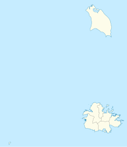
Location of Cape Shirley within Antigua and Barbuda
Cape Shirley is the southernmost point on the island of Antigua in the nation of Antigua and Barbuda. It is located at 17°0′0″N 61°45′0″W / 17.00000°N 61.75000°W between the Caribbean Sea and the Atlantic Ocean.[1]
References
[edit]- ^ "NGA GEOnet Names Server". National Geospatial-Intelligence Agency. 2008-07-07. Archived from the original on 2003-10-08. Retrieved 2008-07-22.

