Jump to content

Welsh Reservoir

Coordinates: 33°04′34.3″N 94°50′18.5″W / 33.076194°N 94.838472°W / 33.076194; -94.838472
From Wikipedia, the free encyclopedia

This is the current revision of this page, as edited by Thief-River-Faller (talk | contribs) at 17:43, 7 June 2024 (Created page with '{{Infobox body of water | name = Welsh Reservoir <!-- Images --> | image = | alt = | caption = | image_bathymetry = | alt_bathymetry = | caption_bathymetry = <!-- Stats --> | location = | group = | coordinates = {{coord|33|04|34.3|N|94|50|18.5|W|region:US_type:waterbody|display =inline,title}} | type = | etymology = | part...'). The present address (URL) is a permanent link to this version.

(diff) ← Previous revision | Latest revision (diff) | Newer revision → (diff)
Welsh Reservoir
Coordinates33°04′34.3″N 94°50′18.5″W / 33.076194°N 94.838472°W / 33.076194; -94.838472
References[1]

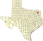
Welsh Reservoir is a lake located south-east of Mount Pleasant, Texas.[2] The reservoir is situated north of Cason.[3]

References

[edit]
  1. ^ U.S. Geological Survey Geographic Names Information System: Welsh Reservoir
  2. ^ "Fishing Lake Welsh". tpwd.texas.gov. Retrieved 2024-06-07.
  3. ^ Association (TSHA), Texas State Historical. "Welsh Reservoir". Texas Almanac. Retrieved 2024-06-07.