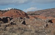
Casamero Pueblo

Casamero Pueblo is an archaeological site including the partially excavated and stabilized ruins of an 11th-century Ancestral Puebloan community in Prewitt, New Mexico, in McKinley County. It was an outlier of Chaco Canyon. It is on the Trail of the Ancients Scenic Byway.
Geography
[edit]The ruins are located on McKinley County Road 19,[1] near Tecolote Mesa. Tecolote means "owl", and the red sandstone mesa has a formation that looks like the eyes of an owl.[2]
History
[edit]
Casamero Pueblo was an outlier of Chaco Canyon between about 1000 to 1125.[2] Built with core-veneer masonry, the pueblo has 22 rooms on the ground floor and may have had 6 rooms on the second story. The settlement had 37 or more additional sites, many masonry dwellings, and a Great Kiva. Andrews Ranch, an outlier within the vicinity, was connected to the pueblo via a Chacoan road.[2]
Between 1966 and 1967 the pueblo was excavated. The masonry was subsequently stabilized.[2]
Facilities
[edit]The ruins are open throughout the year and are accessed via a short trail from the parking lot.[2]
References
[edit]- ^ Trail of the Ancients. Archived August 21, 2014, at the Wayback Machine New Mexico Tourism Department. Retrieved August 14, 2014.
- ^ a b c d e "Casamero Pueblo | Bureau of Land Management". www.blm.gov. Retrieved 2021-01-01.
