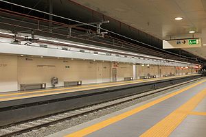
Jonio (Rome Metro)
Appearance
 | |||||||||||
| General information | |||||||||||
| Location | Rome Italy | ||||||||||
| Coordinates | 41°56′47″N 12°31′41″E / 41.94639°N 12.52806°E | ||||||||||
| Owned by | ATAC | ||||||||||
| Construction | |||||||||||
| Structure type | Underground | ||||||||||
| History | |||||||||||
| Opened | 21 April 2015 | ||||||||||
| Services | |||||||||||
| |||||||||||
| |||||||||||
Jonio is an underground station on Line B of the Rome Metro. It is located in the Monte Sacro quarter, under the intersection between Viale Jonio and Via Scarpanto. The station was opened on 21 April 2015.
References
[edit]External links
[edit]![]() Media related to Metropolitana di Roma linea B1 - Jonio at Wikimedia Commons
Media related to Metropolitana di Roma linea B1 - Jonio at Wikimedia Commons


