
Mount Tammany
| Mount Tammany |
|---|
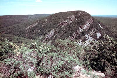
Mount Tammany is the southernmost peak of the Kittatinny Mountains in Warren County, New Jersey. It is 1,526 feet (465 m) tall, and forms the east side of the Delaware Water Gap. Across the Gap is Mount Minsi, on the Pennsylvania side of the river. The mountain is named after the Lenni Lenape chief Tamanend.[2] It lies along the Appalachian Trail in Worthington State Forest. The summit can be hiked by the Mount Tammany Trail ascending the western slopes. This trail head is accessible from Interstate 80.
References
- ^ a b "Mount Tammany". Geographic Names Information System. United States Geological Survey, United States Department of the Interior. 1979-09-08. Retrieved 2009-05-04.
- ^ (Scofield, 38)
External links
This New Jersey state location article is a stub. You can help Wikipedia by expanding it. |