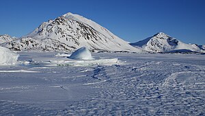
Apusiaajik Island

Apusiaajik Island is an uninhabited island in the Sermersooq municipality on the southwestern shore of Greenland, located at approximately 65°39′N 37°05′W / 65.650°N 37.083°W [1]
Air Iceland STOL aircraft approach Kulusuk Airport on the way from Nerlerit Inaat and Reykjavík flying directly over the southern end of the island.
Geography


Apusiaajik is separated from Kulusuk island in the south by the Ikaasaartik sound; from the small Akinaaq island and tiny skerries in the southwest by the Torssuut Tunoq sound; from Ammassalik island by the Ammassalik fjord, and from the Ingiingaleq and Erqiliqaarteq islands in the east by the Aqartertuluk sound.[1]
The island is very mountainous, with several distinct peaks. The highest summit is Qivtaatit (855m) in the north.[1] The central part of the island is glaciated, with the active Apusiaajik glacier flowing towards Torssuut Tunoq sound.[1][2]
