Oga Quasi-National Park
Appearance
| Oga Quasi-National Park | |
|---|---|
| 男鹿国定公園 | |
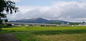
 Mount Kanpū (355 m) | |
 | |
| Location | Akita Prefecture, Japan |
| Area | 81.56 km² |
| Established | 15 May 1975 |
Oga Quasi-National Park (男鹿国定公園, Oga Kokutei Kōen) is a Quasi-National Park on the Oga Peninsula, Akita Prefecture, Japan. Established in 1975, the park is wholly within the city of Oga.[1][2][3][4][5]
See also
Wikimedia Commons has media related to Oga Quasi-National Park.
References
- ^ "栗駒/南三陸金華山/蔵王/男鹿". National Parks Association of Japan. Retrieved 29 February 2012.
- ^ "List of Quasi-National Parks" (PDF). Ministry of the Environment. Retrieved 29 February 2012.
- ^ "Natural Parks of Akita Prefecture" (PDF) (in Japanese). Akita Prefecture. Retrieved 29 February 2012.
- ^ "男鹿国定公園". Ministry of the Environment. Retrieved 29 February 2012.
- ^ "男鹿国定公園". Akita Prefectural Tourism Federation. Retrieved 29 February 2012.
