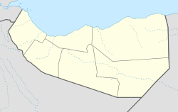
Bohol, Somaliland
Bohol | |
|---|---|
Town | |
| Coordinates: 9°19′36″N 47°17′15″E / 9.32667°N 47.28750°E | |
| Country | |
| Region | Sool |
| District | Xudun |
| Time zone | UTC+3 (EAT) |
Bohol is a town in Xudun District in the Sool region of Somaliland.[1] It is located northwest by road from Xudun.[2][3] It is the second largest town in Xudun District after Xudun.
Overview
Bohol is located between 2 towns which are Dararweyne and Xudun.
The town has a large military base which serves as the official military base for Somaliland in Xudun district and having full control over this district.
Demographics
The small town of Bohol and the surrounding areas such as Ceel La Helay, Sabawanaag, God Gheere, Docolaha has a total population of 5,346 residents. The small town has a booming population and could be a potential capital of the district in the coming future.
The town and it's surroundings is primarily inhabited by people from the Somali ethnic group, with the Sa'ad Yoonis sub-clan of Habar Yoonis well-represented.
References
- ^ Bohol, Somalia
- ^ Google Maps (Map). Google.
{{cite map}}:|access-date=requires|url=(help) - ^ Bing Maps (Map). Microsoft and Harris Corporation Earthstar Geographics LLC.
{{cite map}}:|access-date=requires|url=(help)
External links

