Hadrut
Hadrut
Հադրութ | |
|---|---|
Town | |
 The centre of Hadrut | |
| Coordinates: Template:Xb_type:city 39°31′00″N 47°01′48″E / 39.51667°N 47.03000°E | |
| Country | |
| District | Khojavend |
| Elevation | 720 m (2,360 ft) |
| Population (2015) | |
| • Total | 4,100[1] |
| Time zone | UTC+4 (UTC) |
Hadrut (Template:Lang-hy) is a town in the Khojavend District of Azerbaijan.
History
During the Soviet period, Hadrut became the centre of the Hadrut District of the Nagorno-Karabakh Autonomous Oblast within Azerbaijan SSR. Following the First Nagorno-Karabakh War the city became part of the Hadrut Province of the self-proclaimed Republic of Artsakh.
During the 2020 Nagorno-Karabakh conflict, heavy fighting took place in Hadrut. Azerbaijani captured Hadrut on or around 9 October 2020.[2][3]
Population
The town of Hadrut had around 2,400 registered inhabitants in 1939 of which more than 90% was Armenian,[4] as well as an Armenian majority in 1989.[5]
Economy
The town was home to the Mika-Hadrut Winery, which produced brandy, vodka, and wine.[6]
Gallery
-
General view of Hadrut
-
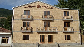
A hotel in Hadrut
-
View of Hadrut streets
-
Surp Harutyun (Holy Resurrection) Church of Hadrut, opened in 1621
Climate
Hadrut has a cold semi-arid climate (BSk) according to the Köppen climate classification.
| Climate data for Hadrut | |||||||||||||
|---|---|---|---|---|---|---|---|---|---|---|---|---|---|
| Month | Jan | Feb | Mar | Apr | May | Jun | Jul | Aug | Sep | Oct | Nov | Dec | Year |
| Mean daily maximum °C (°F) | 4.5 (40.1) |
5.4 (41.7) |
9.2 (48.6) |
16.4 (61.5) |
20.2 (68.4) |
25.2 (77.4) |
28.3 (82.9) |
29.2 (84.6) |
23.7 (74.7) |
18.3 (64.9) |
11.6 (52.9) |
7.1 (44.8) |
16.6 (61.9) |
| Mean daily minimum °C (°F) | −2.9 (26.8) |
−2.3 (27.9) |
0.8 (33.4) |
6.5 (43.7) |
10.8 (51.4) |
14.9 (58.8) |
18.0 (64.4) |
16.9 (62.4) |
13.9 (57.0) |
8.8 (47.8) |
3.7 (38.7) |
−0.4 (31.3) |
7.4 (45.3) |
| Average precipitation mm (inches) | 22 (0.9) |
28 (1.1) |
42 (1.7) |
54 (2.1) |
79 (3.1) |
59 (2.3) |
25 (1.0) |
24 (0.9) |
31 (1.2) |
44 (1.7) |
34 (1.3) |
23 (0.9) |
465 (18.2) |
| Source: http://en.climate-data.org/location/52897/ | |||||||||||||
International relations
During the Armenian control, Hadrut was twinned with the following cities:
 Vagarshapat, Armenia (from 2010)[7]
 Burbank, California, United States (from 2014)[8]
References
- ^ http://stat-nkr.am/files/publications/2015/LXH_tverov_2015.pdf [dead link]
- ^ "President of Azerbaijan: 'Hadrut settlement and several villages liberated from occupation'". APA.az. 9 October 2020. Archived from the original on 10 October 2020. Retrieved 9 October 2020.
Azerbaijan's Hadrut settlement and several villages were liberated from Armenian aggressors, President Ilham Aliyev said this in his address to the nation, APA reports.
- ^ "Azerbaijani MoD shows soldiers who liberated Hadrut from Armenian occupation (PHOTO)". Trend.Az. 2020-10-19. Retrieved 2020-11-14.
- ^ Result of the Soviet census of 1939 of the Hadrut district "/Census Hadrut (in Russian)".
- ^ "Карта 33. Зона конфликта в Нагорном Карабахе (1988–1994...)". iriston.com.
- ^ "Mika-Hadrut at Spyur IS". Spyur.am. Retrieved 2020-10-13.
{{cite web}}: CS1 maint: url-status (link) - ^ "HADRUT". Էջմիածնի քաղաքապետարանի պաշտոնական կայք (Website of the City of Vagarshapat). Retrieved 2020-10-15.
{{cite web}}: CS1 maint: url-status (link) - ^ "Նորություններ - yerkir.am" [Hadrut (NKR) and Burbank (USA) have become sister cities]. www.yerkir.am. Retrieved 2020-10-15.
{{cite web}}: CS1 maint: url-status (link)


