
Search results
The page "Planimetric map" does not exist. You can create a draft and submit it for review or request that a redirect be created, but consider checking the search results below to see whether the topic is already covered.
- Planimetrics is the study of plane measurements, including angles, distances, and areas. To measure planimetrics a planimeter or dot planimeter is used...2 KB (238 words) - 17:09, 1 June 2024
 "chorographic maps" that cover large regions, "planimetric maps" that do not show elevations, and "thematic maps" that focus on specific topics. However, in...20 KB (2,043 words) - 19:20, 2 May 2024
 around, Scott was familiar with the territory having spent months studying maps of the area. He could easily recognize Mons Hadley, Mons Hadley Delta, the...34 KB (5,294 words) - 01:19, 30 January 2024
- level surface upon which to make drawings, charts, and maps while in the field. planimetric map A map which uses a two-dimensional coordinate system, i.e...196 KB (18,440 words) - 15:25, 10 June 2024
 Dune crater, facing north, with Mons Hadley at right. This is part of Pan D-6 in the planimetric map below....6 KB (236 words) - 21:18, 5 May 2024
- topographic maps show relief using contour lines. The USGS calls maps based on topographic surveys, but without contours, "planimetric maps." These maps show...16 KB (1,983 words) - 02:36, 16 June 2024
 to Shorty, which turned out to be titanium-rich pyroclastic glass Planimetric map of Station 4 including the rim of Shorty Shorty, Gazetteer of Planetary...4 KB (398 words) - 16:29, 12 May 2024
 compute the remaining measurements and prepare a two-dimensional or planimetric map. This camera saw extensive use during World War II. "Freedom from dependence...24 KB (3,451 words) - 00:57, 14 March 2024
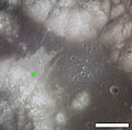
 Planimetric map of Station 3 from the Apollo 15 Preliminary Science Report. X indicates sample locations, 5-digit numbers are LRL sample numbers, rectangle...4 KB (448 words) - 02:10, 17 February 2024
 Ethiopia – United States Mapping Mission (category Maps of Ethiopia)computer-generated photo control points were then used to compile, or draw, the planimetric map to the desired scale and delineate its contours from stereo models...14 KB (1,745 words) - 13:42, 2 January 2024
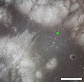 Planimetric map of Station 9 including the rim of Van Serg....10 KB (458 words) - 02:14, 26 January 2024
 Planimetric map of Station 1 from the Apollo 15 Preliminary Science Report. X indicates sample locations, 5-digit numbers are LRL sample numbers, rectangle...6 KB (337 words) - 01:57, 26 January 2024
 based on the presence of rays. (See also section on age below.) Geologic map of North Ray crater Oblique Apollo 14 image, facing east Telephoto image...12 KB (681 words) - 02:11, 26 January 2024
 Institute. Apollo 16 Preliminary Science Report (NASA SP-315), 1972 Geologic Map of the Apollo 16 (Descartes) Landing Area by Apollo Field Geology Investigation...6 KB (404 words) - 02:38, 26 January 2024
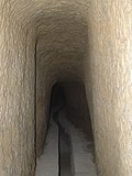 have contracts for 1/2 dado, for 1, 2, 3 dadi, and so on. The oldest planimetric map still in existence dates from 1768 and is now in the Siena State Archives...26 KB (2,394 words) - 05:43, 26 May 2024
 Station 9A planimetric map showing the location of Great Scott at 15555. "X" indicates sample locations, 5-digit numbers are LRL sample numbers, the rectangle...4 KB (354 words) - 04:30, 9 February 2024
 Planimetric map of the Station 3 on the northeast rim of Lara...2 KB (160 words) - 02:05, 26 January 2024
- Union (IAU) Working Group for Planetary System Nomenclature (WGPSN) Geologic Map of the Apollo 16 (Descartes) Landing Area Archived 2019-07-21 at the Wayback...7 KB (410 words) - 23:06, 14 April 2024
 Union (IAU) Working Group for Planetary System Nomenclature (WGPSN) NASA map showing the craters, part of AS16-P-4623 To a Rocky Moon: A Geologist's History...3 KB (263 words) - 01:51, 26 January 2024


- hand, over the whole of its extent. The planimetric scale, identical with that of the large reduction of the map of 1 inch per mile, is of 38 of an inch