Search results
Appearance
The page "Terrestrial+coordinate+system" does not exist. You can create a draft and submit it for review or request that a redirect be created, but consider checking the search results below to see whether the topic is already covered.
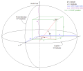
- Earth-fixed coordinate system (acronym ECEF), also known as the geocentric coordinate system, is a cartesian spatial reference system that represents...9 KB (904 words) - 13:39, 7 January 2024
- The equatorial coordinate system is a celestial coordinate system widely used to specify the positions of celestial objects. It may be implemented in spherical...17 KB (1,660 words) - 11:21, 9 June 2024
- In solar observation and imaging, coordinate systems are used to identify and communicate locations on and around the Sun. The Sun is made of plasma, so...9 KB (880 words) - 18:10, 29 June 2024
- Earth. Analogous to terrestrial latitude, galactic latitude is usually measured in degrees (°). The first galactic coordinate system was used by William...15 KB (1,380 words) - 17:53, 30 May 2024
- The European Terrestrial Reference System 1989 (ETRS89) is an ECEF (Earth-Centered, Earth-Fixed) geodetic Cartesian reference frame, in which the Eurasian...6 KB (611 words) - 09:24, 3 July 2024
- A spatial reference system (SRS) or coordinate reference system (CRS) is a framework used to precisely measure locations on the surface of Earth as coordinates...15 KB (1,546 words) - 06:12, 22 May 2024
- A planetary coordinate system (also referred to as planetographic, planetodetic, or planetocentric) is a generalization of the geographic, geodetic, and...19 KB (2,104 words) - 00:55, 9 July 2024
- Earth-fixed coordinate system Earth orientation parameters Geodetic datum International Celestial Reference System and its realizations Terrestrial reference...9 KB (777 words) - 16:49, 25 May 2024
- A projected coordinate system – also called a projected coordinate reference system, planar coordinate system, or grid reference system – is a type of...21 KB (2,803 words) - 22:28, 19 June 2024
- A geographic coordinate system (GCS) is a spherical or geodetic coordinate system for measuring and communicating positions directly on Earth as latitude...22 KB (2,499 words) - 22:33, 8 July 2024
- Transverse Mercator projection (redirect from Gauss–Krüger coordinate system)is oriented with north up. In most applications the Gauss–Krüger coordinate system is applied to a narrow strip near the central meridians where the...37 KB (4,481 words) - 23:46, 27 May 2024
- Geodesy (section Coordinate systems in space)networks, applying space geodesy and terrestrial geodetic techniques, and relying on datums and coordinate systems. Geodetic job titles include geodesist...38 KB (4,245 words) - 00:55, 9 June 2024
- The National Spatial Reference System (NSRS), managed by the National Geodetic Survey (NGS), is a coordinate system that includes latitude, longitude,...6 KB (555 words) - 16:13, 16 April 2024
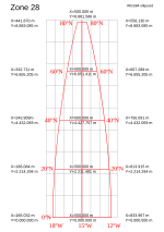
- was used. The World Geodetic System WGS84 ellipsoid is now generally used to model the Earth in the UTM coordinate system, which means current UTM northing...17 KB (2,833 words) - 22:21, 29 June 2024
- defines which coordinate system is used. Most standard coordinates in use today refer to 2000 TT (i.e. to 12h (noon) on the Terrestrial Time scale on...24 KB (3,437 words) - 09:50, 14 July 2024
- spacetime coordinate system relative to an implied observer. In many (but not all) coordinate systems, an event is specified by one time coordinate and three...11 KB (1,514 words) - 16:37, 13 November 2023
- In astronomy, coordinate systems are used for specifying positions of celestial objects (satellites, planets, stars, galaxies, etc.) relative to a given...28 KB (3,974 words) - 03:21, 5 July 2024
- The current version, WGS 84, defines an Earth-centered, Earth-fixed coordinate system and a geodetic datum, and also describes the associated Earth Gravitational...24 KB (2,844 words) - 18:45, 23 June 2024
- Ordnance Survey National Grid (redirect from British national grid reference system)Transverse Mercator (ITM) coordinate reference system was adopted in 2001 and is now the preferred coordinate reference system across Ireland. ITM is based...19 KB (2,151 words) - 18:43, 15 July 2024
- Frame of reference (redirect from Fixed coordinate system)astronomy, a frame of reference (or reference frame) is an abstract coordinate system whose origin, orientation, and scale are specified by a set of reference...30 KB (3,440 words) - 06:14, 22 May 2024
- communications, space radiation environment, terrestrial power systems, exploration geophysics systems, and, conceivably, some aspects of weather and
- link integrating and coordinating the biological and the social worlds. Man is, in the final analysis, a coordinating interface system in the multilevel
- This book is intended to develop content for a new chapter on Coordinate Reference Systems and GNSS Surveying for the Spatial Data Infrastructure Cookbook


