
File:Morocco (orthographic projection, WS claimed).svg

Size of this PNG preview of this SVG file: 550 × 550 pixels. Other resolutions: 240 × 240 pixels | 480 × 480 pixels | 768 × 768 pixels | 1,024 × 1,024 pixels | 2,048 × 2,048 pixels.
Original file (SVG file, nominally 550 × 550 pixels, file size: 632 KB)
| This is a file from the Wikimedia Commons. Information from its description page there is shown below. Commons is a freely licensed media file repository. You can help. |
Summary
| Description |
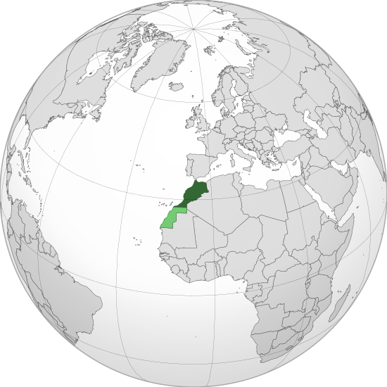
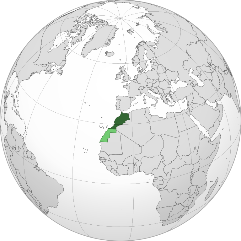
English: Locator of Morocco and the disputed territory Western Sahara shown as claimed (light green) |
| Date | |
| Source | Own derivative from File:Morocco (orthographic projection).svg |
| Author |
Flad and others (see history of original file) Seryo93 (derivative) |
| Other versions |
|
.svg)
.svg)
.svg)
.svg#filehistory)
Licensing

|
Permission is granted to copy, distribute and/or modify this document under the terms of the GNU Free Documentation License, Version 1.2 or any later version published by the Free Software Foundation; with no Invariant Sections, no Front-Cover Texts, and no Back-Cover Texts. A copy of the license is included in the section entitled GNU Free Documentation License. |
| This file is licensed under the Creative Commons Attribution-Share Alike 3.0 Unported license. | ||
| ||
| This licensing tag was added to this file as part of the GFDL licensing update. |
File history
Click on a date/time to view the file as it appeared at that time.
| Date/Time | Thumbnail | Dimensions | User | Comment | |
|---|---|---|---|---|---|
| current | 13:11, 2 July 2021 | | 550 × 550 (632 KB) | M.Bitton | Reverted to version as of 18:58, 31 December 2020 (UTC) |
| 12:11, 2 July 2021 |  | 553 × 553 (189 KB) | Rafiki Eoax | Reverted to version as of 18:39, 21 November 2020 (UTC) | |
| 18:58, 31 December 2020 |  | 550 × 550 (632 KB) | Flaspec | Reverted to version as of 21:01, 28 December 2020 (UTC) See Discussion Page. | |
| 15:25, 29 December 2020 |  | 553 × 553 (251 KB) | EdDakhla | Reverted to version as of 19:02, 28 December 2020 (UTC) Stop reverting, you can upload your centered version of this file under a different name with (centered orthographic projection) like the Libya and Algeria one | |
| 21:01, 28 December 2020 |  | 550 × 550 (632 KB) | Flaspec | Updated. | |
| 19:02, 28 December 2020 |  | 553 × 553 (251 KB) | EdDakhla | Reverted to version as of 18:57, 26 December 2020 (UTC) | |
| 22:56, 26 December 2020 |  | 550 × 550 (633 KB) | Flaspec | Reverted to version as of 18:19, 26 December 2020 (UTC) | |
| 18:57, 26 December 2020 |  | 553 × 553 (251 KB) | EdDakhla | Reverted to version as of 04:53, 25 December 2020 (UTC) | |
| 18:19, 26 December 2020 |  | 550 × 550 (633 KB) | Flaspec | Optimized using SVGOMG. | |
| 17:31, 26 December 2020 |  | 550 × 550 (2.94 MB) | Flaspec | Reverted to version as of 20:49, 21 November 2020 (UTC) This projection is centered towards Morocco, in accordance with other country-related projections. | |
| 04:53, 25 December 2020 |  | 553 × 553 (251 KB) | EdDakhla | Reverted to version as of 12:35, 6 February 2020 (UTC) | |
| 20:49, 21 November 2020 |  | 550 × 550 (2.94 MB) | Flaspec | Latitude and Longitude (slightly more visible). | |
| 20:39, 21 November 2020 |  | 550 × 550 (2.94 MB) | Flaspec | Clearer view of Latitude and Longitude. | |
| 19:38, 21 November 2020 |  | 550 × 550 (2.94 MB) | Christian Ferrer | Reverted to version as of 18:39, 21 November 2020 (UTC) | |
| 18:39, 21 November 2020 |  | 553 × 553 (189 KB) | Taha Khattabi | Reverted to version as of 18:38, 21 November 2020 (UTC) | |
| 18:39, 21 November 2020 |  | 550 × 550 (2.94 MB) | M.Bitton | Reverted to version as of 18:35, 21 November 2020 (UTC) | |
| 18:38, 21 November 2020 |  | 553 × 553 (189 KB) | Taha Khattabi | Fixed border which previously cut into Algeria and higher quality. Morocco controls this portion of Western Sahara, PLEASE DO NOT CHANGE IT!! | |
| 18:36, 21 November 2020 |  | 500 × 500 (167 KB) | Taha Khattabi | Morocco controls this portion of Western Sahara, PLEASE DO NOT CHANGE IT!! | |
| 18:35, 21 November 2020 |  | 550 × 550 (2.94 MB) | M.Bitton | Reverted to version as of 18:18, 21 November 2020 (UTC) | |
| 18:34, 21 November 2020 |  | 500 × 500 (167 KB) | Taha Khattabi | Reverted to version as of 18:13, 21 November 2020 (UTC) | |
| 18:18, 21 November 2020 |  | 550 × 550 (2.94 MB) | M.Bitton | Reverted to version as of 15:03, 21 November 2020 (UTC) | |
| 18:13, 21 November 2020 |  | 500 × 500 (167 KB) | Taha Khattabi | Updated map showing the Moroccan controlled areas in Western Sahara in dark green and claimed but uncontrolled highlighted in light green. | |
| 16:43, 21 November 2020 |  | 553 × 553 (251 KB) | Taha Khattabi | Hello Flaspec and thank you for giving the details about this new projection. (I'm reverting this file because that's the only way I could figure out how to send you a message, I'm still new at this). You may of course revert it back to the latest projection if you wish. Anyway, I have some agreements and disagreements with this new projection I would like to share. I do agree and like the new borders and graphics much more than the older ones as the new ones are HD and more detailed. However... | |
| 15:03, 21 November 2020 |  | 550 × 550 (2.94 MB) | Flaspec | Projection centered towards Morocco. High definition. Clearer view. | |
| 06:22, 21 November 2020 |  | 550 × 550 (306 KB) | Taha Khattabi | Showing centered Africa projection. Previous projection was centered towards Europe | |
| 00:11, 21 November 2020 |  | 550 × 550 (2.94 MB) | Flaspec | Thank you User:Mimauri for your assistance, now i will reconstruct this version to match the original description. | |
| 21:51, 20 November 2020 |  | 550 × 550 (2.94 MB) | Mimauri | updated centering the projection | |
| 12:35, 6 February 2020 |  | 553 × 553 (251 KB) | Rob984 | Clearer view of Morocco. Made with gringer's Perlshaper tool. | |
| 08:37, 27 July 2015 |  | 550 × 550 (306 KB) | Seryo93 | User created page with UploadWizard |
File usage
The following pages on the English Wikipedia use this file (pages on other projects are not listed):
Global file usage
The following other wikis use this file:
- Usage on ady.wikipedia.org
- Usage on arc.wikipedia.org
- Usage on ar.wikipedia.org
- Usage on avk.wikipedia.org
- Usage on bcl.wikipedia.org
- Usage on bg.wikipedia.org
- Usage on bi.wikipedia.org
- Usage on bs.wikipedia.org
- Usage on bxr.wikipedia.org
- Usage on ca.wikipedia.org
- Usage on cs.wikipedia.org
- Usage on el.wikipedia.org
- Usage on en.wiktionary.org
- Usage on fa.wikipedia.org
- Usage on fi.wikipedia.org
- Usage on fr.wikipedia.org
- Usage on gu.wikipedia.org
- Usage on he.wikipedia.org
- Usage on hi.wikipedia.org
- Usage on hr.wikipedia.org
- Usage on incubator.wikimedia.org
- Usage on is.wikipedia.org
- Usage on it.wikipedia.org
- Usage on ja.wikipedia.org
- Usage on ka.wikipedia.org
- Usage on kcg.wikipedia.org
- Usage on ko.wikipedia.org
- Usage on kv.wikipedia.org
- Usage on lo.wikipedia.org
- Usage on lt.wikipedia.org
- Usage on lv.wikipedia.org
- Usage on mdf.wikipedia.org
- Usage on mhr.wikipedia.org
- Usage on mi.wikipedia.org
- Usage on mn.wikipedia.org
- Usage on mt.wikipedia.org
- Usage on nds-nl.wikipedia.org
- Usage on nl.wikipedia.org
- Usage on pl.wikipedia.org
- Usage on pt.wikipedia.org
- Usage on pt.wikiquote.org
- Usage on ru.wikipedia.org
- Usage on ru.wiktionary.org
- Usage on shn.wikipedia.org
- Usage on simple.wikipedia.org
View more global usage of this file.
.svg)
.svg)