
File:Western Balkans.PNG

Size of this preview: 644 × 599 pixels. Other resolutions: 258 × 240 pixels | 516 × 480 pixels | 826 × 768 pixels | 1,101 × 1,024 pixels | 1,606 × 1,494 pixels.
Original file (1,606 × 1,494 pixels, file size: 344 KB, MIME type: image/png)
| This is a file from the Wikimedia Commons. Information from its description page there is shown below. Commons is a freely licensed media file repository. You can help. |

|
This locator map image could be re-created using vector graphics as an SVG file. This has several advantages; see Commons:Media for cleanup for more information. If an SVG form of this image is available, please upload it and afterwards replace this template with
{{vector version available|new image name}}.
It is recommended to name the SVG file “Western Balkans.svg”—then the template Vector version available (or Vva) does not need the new image name parameter. |
Summary
| Description |
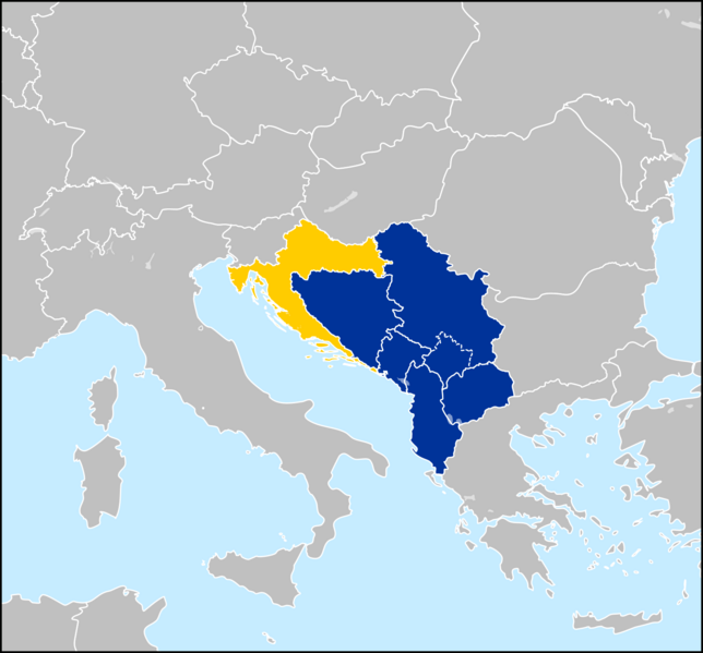
English: Countries of the Western Balkans; Albania, Bosnia & Herzegovina, Montenegro, North Macedonia and Serbia. Kosovo, whose independence is disputed, is also demarkated.
Croatia, sometimes considered a part of the Western Balkans. It joined the EU in 2013. |
| Date | |
| Source | Own work |
| Author | Olahus |
| Other versions |
Derivative works of this file: |
Licensing
Olahus, the copyright holder of this work, hereby publishes it under the following license:
This file is licensed under the Creative Commons Attribution-Share Alike 3.0 Unported license.
Attribution: Olahus
- You are free:
- to share – to copy, distribute and transmit the work
- to remix – to adapt the work
- Under the following conditions:
- attribution – You must give appropriate credit, provide a link to the license, and indicate if changes were made. You may do so in any reasonable manner, but not in any way that suggests the licensor endorses you or your use.
- share alike – If you remix, transform, or build upon the material, you must distribute your contributions under the same or compatible license as the original.
File history
Click on a date/time to view the file as it appeared at that time.
| Date/Time | Thumbnail | Dimensions | User | Comment | |
|---|---|---|---|---|---|
| 14:34, 18 October 2009 |  | 606 × 570 (17 KB) | Turkish Flame~commonswiki | Reverted to version as of 16:43, 5 January 2009 | |
| 20:12, 7 February 2009 |  | 606 × 570 (17 KB) | Casper 511~commonswiki | Reverted to version as of 20:16, 17 July 2008 Kosovo is partly recognised | |
| 16:43, 5 January 2009 |  | 606 × 570 (17 KB) | Turkish Flame~commonswiki | updated according to the EU – [http://europa.eu/abc/european_countries/others/serbia/index_en.htm] | |
| 20:16, 17 July 2008 |  | 606 × 570 (17 KB) | Finavon | border cropped | |
| 21:42, 16 July 2008 |  | 616 × 580 (23 KB) | Olahus | {{Information |Description={{en|1=The Western Balkans.}} |Source=Own work by uploader |Author=Olahus |Date= |Permission= |other_versions= }} {{ImageUpload|full}} Category:Category:Maps of the Balkans |
File usage
The following pages on the English Wikipedia use this file (pages on other projects are not listed):
Global file usage
The following other wikis use this file:
- Usage on az.wikipedia.org
- Usage on be.wikipedia.org
- Usage on cs.wikipedia.org
- Usage on et.wikipedia.org
- Usage on fr.wikipedia.org
- Usage on fr.wiktionary.org
- Usage on ja.wikipedia.org
- Usage on kk.wikipedia.org
- Usage on mk.wikipedia.org
- Usage on nl.wikipedia.org
- Usage on no.wikipedia.org
- Usage on ro.wikipedia.org
- Usage on ru.wikipedia.org
- Usage on sh.wikipedia.org
- Usage on sq.wikipedia.org
- Usage on sr.wikipedia.org
- Usage on sr.wikinews.org
- Usage on uk.wikipedia.org
- Usage on www.wikidata.org
- Usage on zh.wikipedia.org