Oru Parish
Oru Parish
Oru vald | |
|---|---|
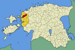
 Oru Parish within Lääne County in 2009. | |
| Country | Estonia |
| County | Lääne County |
| Administrative centre | Linnamäe |
| Area | |
| • Total | 197.7 km2 (76.3 sq mi) |
| Population (2008) | |
| • Total | 932 |
| • Density | 4.7/km2 (12/sq mi) |
| Website | www |
Oru Parish (Estonian: Oru vald) was a rural municipality in Lääne County, Estonia,[1] that existed from 1992 to 2013.
After the municipal elections held on 20 October 2013, Oru Parish was merged with neighbouring Risti and Taebla parishes and a new Lääne-Nigula Parish was established.
In 2008 it had a population of 932 and an area of 197.7 km².
Settlements[edit]
Oru Parish had 15 villages:Auaste, Ingküla, Jalukse, Keedika, Kärbla, Linnamäe, Niibi, Oru, Mõisaküla, Salajõe, Saunja, Seljaküla, Soolu, Uugla and Vedra.
References[edit]
- ^ "X-GIS(3) Portal". xgis.maaamet.ee. Retrieved 2 February 2022.
External links[edit]
- Official website (in Estonian)
58°59′42″N 23°42′46″E / 58.99500°N 23.71278°E


