
Philipp Clüver

Philipp Clüver (also Klüwer, Cluwer, or Cluvier, Latinized as Philippus Cluverius) (1580 – 1623) was a German geographer and historian.
Clüver was born in Danzig, Prussia [1] [2], (since 1945 Gdańsk, Poland). After travelling in Germany and around Poland, during which he learned Polish, he began the study of law at Leiden, but soon he turned his attention to history and geography, which were then taught there by Joseph Scaliger.
Clüver received science education from his father, who was Münzmeister at Danzig (coin master), but when Clüver went into different studies and much travel throughout Europe, the father stopped supporting his studies. He travelled through Germany, Hungary, and Bohemia, where he served for the military, but when he translated into Latin a defense by Baron Popel Lobkowitz, who was imprisoned, the Austrian authorities did not look kindly on his activities. Clüver also travelled in England, Scotland, and France. He did all travel on foot, he finally settling in Holland, where (after 1616) he received a regular pension from the University of Leiden.
Clüver was an antiquary, who was given a special appointment at Leiden as geographer and put in charge of the university's library, but his life's project, it developed, was a general study of the geography of Antiquity, based not only on classical literary sources, but — and this was his contribution — supplemented by wide travels and local inspections. He became virtually the founder of historical geography.
Clüver's first work, in 1611, concerning the lower reaches of the Rhine and its tribal inhabitants in Roman times (Commentarius de tribus Rheni alveis, et ostiis; item. De Quinque populis quondam accolis; scilicet de Toxandris, Batavis, Caninefatibus, Frisiis, ac Marsacis) touched a source of national pride among the Seventeen Provinces, for the Dutch were enjoying an eight years' truce in their Eighty Years' War of liberation.
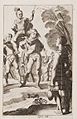
Clüver's Germaniae antiquae libri tres (Leiden, 1616) depends on Tacitus and other Latin authors. A volume on the antiquities of Sicily, with notes on Sardinia and Corsica (Sicilia Antiqua cum minoribus insulis ei adjacentibus item Sardinia et Corsica), published at Leiden by Louis Elsevier in 1619, is a useful source, with many reference from writers of Antiquity and maps that are often detached and sold to map collectors. His Introductio in universam geographiam (published in 1624) became a standard geographical textbook.
Clüver was also a prolific a writer on mathematical and theological subjects. He is remembered by collectors and historians of cartography for his edition of Ptolemy's Geographia (based on Mercator's edition of 1578) and for miniature atlases that were reprinted for most of the 17th century. Many of his maps were etched for him by Petrus Bertius.
Works
- Germania Antiqua (1616)
- Siciliae Antiquae libri duo (1619)
- Sardinia et Corsica Antiqua (1619)
- Italia Antiqua (1624, posthumous)
- Introductio in Universam Geographiam (1629)
Gallery
-
 Germania antiqua, Pl. 11
 -
 Germania antiqua, Pl. 17
 -
 Germania antiqua, Pl. 18
 -
 Germania antiqua, Pl. 24


External links
- Philipp Clüver in Allgemeine Deutsche Biographie
- Civitates Liber Imperiales Danzig in Prussia (Free Imperial city) list from 1615 by historian Petrus Bertius
- Philipp Cluver
- St John's College, Cambridge: note on Philipp Cluver
- Philipp Cluvier: note under No. 52
This article incorporates text from a publication now in the public domain: Chisholm, Hugh, ed. (1911). Encyclopædia Britannica (11th ed.). Cambridge University Press. {{cite encyclopedia}}: Missing or empty |title= (help)