
Search results
The page "Cartographic.info" does not exist. You can create a draft and submit it for review or request that a redirect be created, but consider checking the search results below to see whether the topic is already covered.
 {{cite journal}}: Cite journal requires |journal= (help) Cartographic.info USA http://cartographic.info/usa/map.php?id=715379 U.S. Government Printing Office...8 KB (518 words) - 21:23, 3 February 2024
 Map projection (redirect from Cartographic projection)(SE16.info). Map Projections (MathWorld). MapRef: The Internet Collection of MapProjections and Reference Systems in Europe PROJ.4 – Cartographic Projections...58 KB (6,482 words) - 15:55, 11 January 2024
 There have been other military tests there. List of valleys of Nevada Cartographic.info Map of Tikaboo Valley in Lincoln, Nevada: Lat-Long.com Tikaboo Valley...2 KB (195 words) - 17:29, 8 June 2020
- Retrieved 12 June 2023. "Map of Suggi Lake in Saskatchewan:". Cartographic.info. Cartographic.info. Retrieved 12 June 2023. "Grassberry River". Canadian Geographical...5 KB (388 words) - 04:28, 22 April 2024
 Map symbol (redirect from Cartographic symbol)A map symbol or cartographic symbol is a graphical device used to visually represent a real-world feature on a map, working in the same fashion as other...19 KB (2,107 words) - 08:59, 22 December 2023
- Thompson Citizen. Retrieved September 4, 2014. "Map of Norman Mitchell Lake in 77-8E, Manitoba". Cartographic.info. Retrieved November 10, 2021. v t e v t e...2 KB (115 words) - 20:48, 9 May 2024
 Battalion. "Map of Chichagof Harbor in Aleutians West (CA), Alaska". Cartographic.info. Retrieved March 20, 2015. Merriam-Webster's Geographical Dictionary...3 KB (142 words) - 15:55, 9 September 2023
- "Map of Ilejemeje Local Government Area in Ekiti, Nigeria". www.cartographic.info. Retrieved 2023-08-19. "Ilejemeje Local Government Area". www.manpower...4 KB (201 words) - 20:58, 16 February 2024
- hectares. It was classified as a nature reserve in 2009. "Map of Djebel Bent Ahmed in Jendouba, Tunisia". Cartographic.info. Retrieved 2017-03-03. v t e...523 bytes (45 words) - 13:57, 30 August 2018
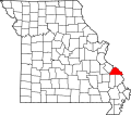 spoken of as Altenburg, where it is exhibited today. cartographic.info http:// cartographic.info/usa/map.php?id=736914 State Historical Society of Missouri:...5 KB (337 words) - 05:35, 14 February 2024
 Katherine and the Sinai mountains A Report on Mount Sinai Old maps of Mount Sinai. Eran Laor Cartographic Collection, The National Library of Israel....10 KB (819 words) - 10:12, 6 May 2024
 "Street map of Algonquin Road in Township of Augusta, Ontario, Canada". cartographic.info. "Google Maps". Google Maps. Goldie A. Connell (1985) Augusta: Royal...137 KB (17,323 words) - 09:53, 28 April 2024
- close to Vlampouros Mountain. "Map of Vlampouros in Paphos, Cyprus". cartographic.info. Retrieved 2019-07-23. Ekdoseis Horama (Firm) (c. 2011), Paphos :...5 KB (270 words) - 16:26, 15 April 2020
 December 2023. "Map of Pasquia River Recreation Site in Saskatchewan:". Cartographic.info. Retrieved 6 December 2023. "Pasquia River Recreation Site". Canadian...7 KB (470 words) - 10:51, 10 April 2024
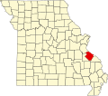 microbrewery as well as the 165 acre Crown Valley Winery. Cartographic.info http://cartographic.info/usa/map.php?id=716070 Roadsidethoughts.com http://www...5 KB (250 words) - 15:16, 23 July 2023
 Overflowing River in Saskatchewan:". Cartographic.info. Retrieved 4 November 2023. "Overflowing River Provincial Park". Geoview.info. Retrieved 4 November 2023...7 KB (487 words) - 08:26, 27 March 2024
- have been originally settled by the Saxons in 1839. cartographic.info http:// cartographic.info/usa/map.php?id=739094 State Historical Society of Missouri:...4 KB (320 words) - 06:55, 25 July 2022
- Kigilyakh "Map of Khrebet Kyuntas in Sakha (Yakutiya), Russia". cartographic.info. Retrieved 2022-10-08. Natural regions of the U.S.S.R - Internet Archive...4 KB (329 words) - 10:06, 5 December 2023
- 2023. "Map of Duncairn Reservoir Bird Sanctuary in Saskatchewan". Cartographic.info. Retrieved 22 May 2023. "Duncairn Reservoir : Cottages and Camping"...8 KB (817 words) - 04:16, 22 April 2024
- Clearwater in 1929, and remained in operation until 1981. Cartographic.info http://cartographic.info/usa/map.php?id=735962 Roadsidethoughts.com "Clearwater...4 KB (159 words) - 16:45, 12 October 2023


- architectural draftsmen, structural steelwork draftsmen, electrical draftsmen, cartographic draftsmen, and ordnance draftsmen, including assistant or lower class
- Planet and satellite shapes from the IAU/IAG Working Group (WG) on Cartographic Coordinates and Rotational Elements Presumably stars would then behave