
Search results
There is a page named "Topozone.com" on Wikipedia
- TopoZone is a website operated by Locality LLC that offers free online topographic maps. It was founded in November 1999 by Ed McNierney whose company...3 KB (309 words) - 05:17, 1 February 2024
 Georgia Atlas & Gazetteer. DeLorme. 2001. ISBN 978-0-89933-253-6. and Topozone.com. Accessed November 8, 2022. Altamaha River Delta | WHSRN.org, WHSRN "A...20 KB (2,105 words) - 16:40, 21 February 2024
 (June 16, 1960; retrieved December 23, 2010.) "www.topozone.com showing Oregon, Pennsylvania". Topozone.com. Retrieved October 9, 2011. History: Our Story...124 KB (9,826 words) - 10:55, 8 May 2024
 Bullheadcity.com. August 28, 1984. Retrieved January 5, 2012. "Bulls Head Rock USGS Davis Dam Quad, AZ, NV, Topographic Map". Topozone.com. Retrieved January...58 KB (5,974 words) - 03:34, 21 April 2024
 2016-08-10. "Mount Eddy Topo Map, Siskiyou and Trinity Counties CA". Topozone.com. "Research Natural Area Establishment Record" (PDF). Retrieved 2022-01-06...7 KB (450 words) - 02:15, 29 September 2023
 25, 2012. "Map". topozone.com. Archived from the original on July 24, 2014. Retrieved July 21, 2015. "State Topo Maps". TopoZone.com. Retrieved March...109 KB (9,894 words) - 17:22, 7 May 2024
 rentals available. Topozone website, at https://www.topozone.com/missouri/jackson-mo/reservoir/lake-jacomo/ . AnyplaceAmerica.com website, at https://www...4 KB (240 words) - 08:47, 4 December 2023
 southeast end of Chuckwalla Valley, topozone Ford Lake (Ford Dry Lake), coordinates & elevation at topozone.com Media related to Chuckwalla Valley at...5 KB (167 words) - 02:46, 29 March 2021
 Statistical Areas". alabama.hometownlocator.com. Retrieved 2021-11-04. "Alabama Topographic Maps by Topo Zone". Topozone.com. Retrieved 2019-07-09. "Koppen Classification"...13 KB (1,197 words) - 18:51, 23 March 2024
 Washington Road & Recreation Atlas. Benchmark Maps. 2000. and http://www.topozone.com Morgan, Murray (1979). Puget's Sound: A Narrative of Early Tacoma and...12 KB (1,195 words) - 19:15, 23 March 2024
- "Waterford Hill, MI". itouchmap.com. Retrieved 4 June 2016. "Waterford Hill Topo Map, Oakland County MI (Clarkston Area)". topozone.com. Retrieved 4 June 2016...11 KB (1,200 words) - 19:24, 9 November 2023
 Brothers. 2000. p. 169, P, N. USGS benchmark, quad located at http://www.topozone.com/map.asp?lon=-122.1207961&lat=37.2582767&datum=nad83 "Rotary Club of Los...15 KB (1,930 words) - 23:48, 27 September 2023
 active link shows the Creek as "West Chickamauga Creek" According to the topozone.com topographical map, the length of West Chickamauga Creek is more than...9 KB (847 words) - 19:37, 29 March 2023
 the original on July 23, 2022. Retrieved July 23, 2022. - Text list "Topozone.com Sutor, Clark County NV (accessed 10 February 2019)". Wikimedia Commons...59 KB (4,889 words) - 03:44, 7 May 2024
 "Federal Spring Branch Topo Map, Prince George's County MD (Bristol Area)". topozone.com. Retrieved May 15, 2018. "Decennial Census by Decade". US Census Bureau...48 KB (4,396 words) - 03:36, 7 April 2024
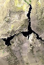 Survey Geographic Names Information System: White Hills Senator Mountain, topozone.com Richard E. Lingenfelter, Steamboats on the Colorado River, 1852–1916...3 KB (225 words) - 16:56, 12 April 2023
 Sandstone. Aerial view, & 7,119 ft, Mather Point, Mountainzone Marher Point, Topozone.com Wikimedia Commons has media related to Mather Point. Aerial view: Mather...4 KB (281 words) - 03:51, 7 January 2022
 Windsor Locks topographic 41° 58' 13"N, 72° 44' 24"W (NAD83/WGS84) via Topozone.com. Connecticut Forest and Park Association NPS brochure for National Scenic...8 KB (801 words) - 09:20, 3 November 2023
 Eagle Valley. "Map". www.topozone.com. "Abandoned & Little-Known Airfields: North-Central Pennsylvania". www.airfields-freeman.com. Retrieved 2024-03-07...9 KB (996 words) - 17:13, 24 April 2024
- Resources Canada 100 MILE HOUSE Quad, British Columbia, Topographic Map". Topozone.com. Santa Monica, California: Demand Media. Retrieved 8 November 2014. v...1 KB (74 words) - 01:09, 16 April 2024


