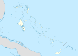
Sweeting Cay
Sweeting Cay | |
|---|---|
| Coordinates: 26°37′08″N 77°51′48″W / 26.61889°N 77.86333°W | |
| Country | |
| Island | Grand Bahama |
| District | East Grand Bahama |
| Population (2012) | |
| • Total | 516 |
| Time zone | UTC-5 (Eastern Time Zone) |
| Area code | 242 |
Sweeting Cay is a town in the Bahamas, located on Grand Bahama island. It has a population of 516 (2012 estimates).[1] Sweeting Cay is a small fishing village that is the easternmost on the island.[2]
It is 180 km north of the capital Nassau. Sweeting Cay is 3 meters above sea level.[3] It is north of East Grand Bahama National Park.[4]
References[edit]
- ^ World Gazetteer
- ^ A Tour Of Grand Bahama Tribune 242
- ^ Sweeting Cay at GeoNames.org
- ^ Oban Deal: We’Ll Never Support It Tribune 242

