
Üchtelhausen
Üchtelhausen | |
|---|---|
 Coat of arms | |
Location of Üchtelhausen within Schweinfurt district 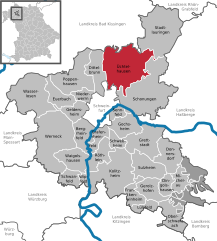 | |
 Üchtelhausen  Üchtelhausen | |
| Coordinates: 50°5′N 10°16′E / 50.083°N 10.267°E | |
| Country | Germany |
| State | Bavaria |
| Admin. region | Lower Franconia |
| District | Schweinfurt |
| Subdivisions | 9 districts |
| Government | |
| • Mayor | Birgit Göbhardt (WG Zell) |
| Area | |
| • Total | 62.15 km2 (24.00 sq mi) |
| Elevation | 322 m (1,056 ft) |
| Population (2022-12-31)[1] | |
| • Total | 3,881 |
| • Density | 62/km2 (160/sq mi) |
| Time zone | UTC+01:00 (CET) |
| • Summer (DST) | UTC+02:00 (CEST) |
| Postal codes | 97532 |
| Dialling codes | 09720 |
| Vehicle registration | SW |
| Website | www.uechtelhausen.de |
Üchtelhausen is a municipality and community in the district of Schweinfurt in Bavaria, Germany.
Geography
Üchtelhausen is located in region Main - Rhön Mountains.
It exists following districts: Ebertshausen, Hesselbach, Hoppachshof, Madenhausen, Ottenhausen, Thomashof, Weipoltshausen, Zell, Üchtelhausen.
Demography

References
- ^ Genesis Online-Datenbank des Bayerischen Landesamtes für Statistik Tabelle 12411-003r Fortschreibung des Bevölkerungsstandes: Gemeinden, Stichtag (Einwohnerzahlen auf Grundlage des Zensus 2011) (Hilfe dazu).
| International | |
|---|---|
| National | |
This Schweinfurt district location article is a stub. You can help Wikipedia by expanding it. |