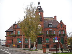
Łasin
Łasin | |
|---|---|
 Łasin Town Hall | |
| Country | |
| Voivodeship | Kuyavian-Pomeranian |
| County | Grudziądz |
| Gmina | Łasin |
| Area | |
• Total | 4.79 km2 (1.85 sq mi) |
| Population (2006) | |
• Total | 3,276 |
| • Density | 680/km2 (1,800/sq mi) |
| Postal code | 86-320 |
| Website | http://www.lasin.pl/ |
Łasin [ˈwaɕin] (Template:Lang-de) is a town in Grudziądz County, Kuyavian-Pomeranian Voivodeship, Poland, with 3,271 inhabitants (2004). It is the seat of the gmina (administrative district) called Gmina Łasin. It lies approximately 25 kilometres (16 mi) east of Grudziądz and 78 km (48 mi) north-east of Toruń. Heiner Stadler was born in Łasin.
History
Brothers Mateusz and Jakub owned land near Łasinka River (Łasin), year 1298, taken from them by the Country Master of the Teutonic Order Meinhard von Querfurt and given to Jan de Nemore who found the village of Łasin. In 1298, the town received German Magdeburg law city rights from the monastic state of the Teutonic Knights it was located in. Between 1466 and 1772, the town belonged to the Polish province of Royal Prussia. Following the First Partition of Poland in 1772, the town (then called Lessen) was annexed by the King Frederick II of Prussia and made part of the German Kingdom of Prussia. In 1871, during the unification of Germany, it became part of the Prussian-led German Empire. In 1920, in accordance with the Treaty of Versailles, Łasin became part of the newly created Polish republic.


53°31′N 19°05′E / 53.517°N 19.083°E


