
Search results
The page "Surface-survey" does not exist. You can create a draft and submit it for review or request that a redirect be created, but consider checking the search results below to see whether the topic is already covered.
 determine their own position when beginning a new survey. Survey points are usually marked on the earth's surface by objects ranging from small nails driven...56 KB (7,086 words) - 19:04, 7 June 2024
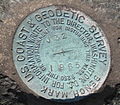 Survey markers, also called survey marks, survey monuments, or geodetic marks, are objects placed to mark key survey points on the Earth's surface. They...10 KB (1,244 words) - 18:30, 29 November 2023
 Archaeology (section Field survey)the surface. Surface survey cannot detect sites or features that are completely buried under earth, or overgrown with vegetation. Surface survey may also...133 KB (13,769 words) - 14:16, 25 May 2024
 visible as surface features. Using modern maps to transcribe or re-project earlier maps can help to locate these features with contemporary survey controls...24 KB (3,361 words) - 04:54, 5 March 2024
 availability. The task of survey vessels is to map the bottom, and measure the characteristics of the benthic zone, full water column, and surface for the purpose...9 KB (867 words) - 06:03, 4 April 2024
 Surface tension is the tendency of liquid surfaces at rest to shrink into the minimum surface area possible. Surface tension is what allows objects with...71 KB (8,776 words) - 21:23, 11 May 2024
 Topography (redirect from Topographic survey)exploration have been primary motivators to start survey programs, but detailed information about terrain and surface features is essential for the planning and...16 KB (1,968 words) - 05:19, 16 May 2024
 Surface runoff (also known as overland flow or terrestrial runoff) is the unconfined flow of water over the ground surface, in contrast to channel runoff...41 KB (5,183 words) - 10:28, 2 June 2024
- as the intersection of faults with the land surface). The maps and reports created by geological survey organisations generally aim for geographic continuity...4 KB (445 words) - 15:41, 14 June 2022
- The National Geodetic Survey (NGS) is a United States federal agency based in Washington, D.C. that defines and manages a national coordinate system, providing...7 KB (772 words) - 04:42, 11 May 2024
- Mine surveying is the practice of determining the relative positions of points on or beneath the surface of the earth by direct or indirect measurements...1 KB (83 words) - 22:10, 28 September 2023
 is similar to a magnetic survey carried out with a hand-held magnetometer, but allows much larger areas of the Earth's surface to be covered quickly for...5 KB (558 words) - 17:42, 21 October 2023
- 1973, a three-day surface survey of the site was conducted by Harriet P. Martin. Consisting mainly of pottery shard collection, the survey confirmed that...26 KB (3,100 words) - 13:21, 5 June 2024
 Earth (redirect from Surface area of earth)being an ocean world, the only one in the Solar System sustaining liquid surface water. Almost all of Earth's water is contained in its global ocean, covering...219 KB (19,285 words) - 23:17, 7 June 2024
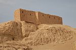 political role in the Ur III period. In 2016 the QADIS survey project, carried out an aerial and surface survey of the site. Four bricks (three re-used for a later...54 KB (7,187 words) - 22:46, 5 June 2024
 An unmanned surface vehicle, unmanned surface vessel or uncrewed surface vessel (USV), colloquially called a drone boat, drone ship or sea drone, is a...56 KB (5,088 words) - 10:30, 30 May 2024
 Impervious surfaces are mainly artificial structures—such as pavements (roads, sidewalks, driveways and parking lots, as well as industrial areas such...22 KB (2,788 words) - 20:33, 20 March 2024
 Geodesy (redirect from Geodetic survey)Earth's gravitational field. This applies to the solid surface, the liquid surface (dynamic sea surface topography), and Earth's atmosphere. For this reason...38 KB (4,245 words) - 00:55, 9 June 2024
 Surface-supplied diving equipment (SSDE) is the equipment required for surface-supplied diving. The essential aspect of surface-supplied diving is that...72 KB (9,240 words) - 13:43, 22 April 2024
- alternative to surface survey that does not involve the collection of artefacts'. It can be faster and less time-consuming than surface survey. Advanced spaceborne...24 KB (2,745 words) - 14:20, 2 June 2024


- Harmonium by Wallace Stevens Of the Surface of Things 4373389Harmonium — Of the Surface of ThingsWallace Stevens Of the Surface of Things I In my room, the
- general ruled surface of revolution which can degenerate into a cylinder, a cone, or a plane is the hyperboloid. E. Asadzadeh & M. Alam, A Survey on Hyperbolic
- because of the technical limitations of the Module used. A Chronological Survey of Sedimentary Landforms in the Continental United States The current, editable