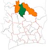
Sirasso
Appearance
Sirasso | |
|---|---|
Town, sub-prefecture, and commune | |
| Coordinates: 9°17′N 6°6′W / 9.283°N 6.100°W | |
| Country | |
| District | Savanes |
| Region | Poro |
| Department | Korhogo |
| Population (2014)[1] | |
| • Total | 28,160 |
| Time zone | UTC+0 (GMT) |
Sirasso is a town in northern Ivory Coast. It is a sub-prefecture and commune of Korhogo Department in Poro Region, Savanes District.
In 2014, the population of the sub-prefecture of Sirasso was 28,160.[2]
Villages
[edit]The 14 villages of the sub-prefecture of Sirasso and their population in 2014 are:[2]
- Nangberekaha (478)
- Peletiminin (198)
- Sirasso (8 869)
- Soumon (225)
- Dagba (3 610)
- Dokaha (884)
- Lopin (386)
- M'balla (2 734)
- Nouhouo (355)
- Sakpele (1 977)
- Sambokaha (1 711)
- Seguebe (758)
- Soloboho (258)
- Tallere (5 717)
Notes
[edit]- ^ "Côte d'Ivoire". geohive.com. Retrieved 7 December 2015.
- ^ a b "RGPH 2014, Répertoire des localités, Région Poro" (PDF). ins.ci. Retrieved 5 August 2019.


