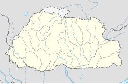
Tang Valley
Appearance
Tang Valley is one of the four valleys of Bumthang District, Bhutan.[1]
Tang Valley | |
|---|---|
| Coordinates: 27°45′8″N 90°40′40″E / 27.75222°N 90.67778°E | |
| Area | |
| • Total | 562.00 ha (1,388.74 acres) |
| Elevation | 2,800 - 5,000 m (−13,600 ft) |
| Population | |
| • Total | 1,816 |
| Time zone | UTC+6 (Bhutan Time) |
It is located 11 km away from Jakar, the administrative center of Bumthang District, Bhutan. It trails higher up the lake called Mebartsho.[2]
References
- ^ "Tang Valley, Bumthang Bhutan". www.windhorsetours.com. Retrieved 2020-06-11.
- ^ "Tang Valley travel". Lonely Planet. Retrieved 2020-06-11.
Resource

