Parnamirim
Parnamirim | |
|---|---|
Municipality | |
| The Municipality of Trampolim da Vitória de Parnamirim | |
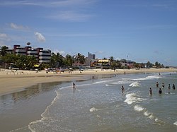
 Pirangi do Norte Beach | |
| Nickname: "Trampolim da Vitória" ("Trampoline of Victory") | |
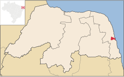
 Location of Parnamirim in the State of Rio Grande do Norte | |
 Location of Rio Grande do Norte in Brazil | |
| Coordinates: 5°55′S 35°15′W / 5.917°S 35.250°W | |
| Country | |
| Region | Northeast |
| State | |
| Founded | 1958 |
| Government | |
| • Mayor | Rosano Taveira (PRB) |
| Area | |
| • Total | 123.471 km2 (47.672 sq mi) |
| Population (2020 [1]) | |
| • Total | 267,036 |
| • Density | 2,200/km2 (5,600/sq mi) |
| Time zone | UTC-3 |
| HDI (2010) | 0.766 [2] – high |
| Website | parnamirim |
Parnamirim is a city in the state of Rio Grande do Norte, Brazil, next to the state capital city of Natal and part of its metropolitan area. The Natal Air Force Base and the adjoining Augusto Severo International Airport, the now closed civilian airport that used to serve Natal, are located there, as well as the Barreira do Inferno rocket launch base.

References
External links
 Media related to Parnamirim at Wikimedia Commons
 Parnamirim travel guide from Wikivoyage


