Karabakh Range
Appearance
| Karabakh Range | |
|---|---|
 Highest point in the Karabakh range, Mount Kirs | |
| Highest point | |
| Elevation | 2,724 m (8,937 ft) |
| Parent peak | Mount Kirs |
| Coordinates | 39°42′0″N 46°44′30″E / 39.70000°N 46.74167°E |
| Naming | |
| Native name | Qarabağ silsiləsi Error {{native name checker}}: parameter value is malformed (help) |
| Geography | |
| Parent range | Lesser Caucasus |
The Karabakh Range is a mountain range of Lesser Caucasus. It is an arc stretching from North to South-East from Tartar river to Aras River. The Hakari River (left tributary of the Aras) separates it from the Karabakh Plateau. The highest point is Mount Kirs (Template:Lang-az, lit. 'Great Kirs') (2725 m).[1]
Gallery
-
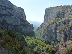
Canyon near Shusha
-
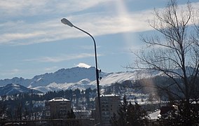
Mount Kirs as seen from Shusha
References
39°35′01″N 46°44′37″E / 39.5836°N 46.7436°E


