
Manduri
Manduri | |
|---|---|
 | |
 Flag  Coat of arms | |
 Location in São Paulo state | |
 Manduri Location in Brazil | |
| Coordinates: 23°0′12″S 49°19′19″W / 23.00333°S 49.32194°W | |
| Country | Brazil |
| Region | Southeast |
| State | São Paulo |
| Area | |
| • Total | 229 km2 (88 sq mi) |
| Elevation | 710 m (2,330 ft) |
| Population (2020 [1]) | |
| • Total | 9,910 |
| • Density | 43/km2 (110/sq mi) |
| Time zone | UTC-03:00 (BRT) |
| • Summer (DST) | UTC-02:00 (BRST) |
Manduri is a municipality (município) in the state of São Paulo in Brazil. The population is 9,910 (2020 est.) in an area of 229 km².[2] The elevation is 710 m.
Pictures
-
 The forest, in Manduri
 -
 Black capuchin
 -
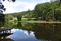 Forest
 -
 Portal
 -
 Detail in the portal, Santo Antonio picture
 -
 A street with trees
 -
 Intersection from Manduri to Águas de Sta. Bárbara
 -
 Motocross track

_REFON.jpg)


.JPG)


References
This geographical article relating to the state of São Paulo is a stub. You can help Wikipedia by expanding it. |