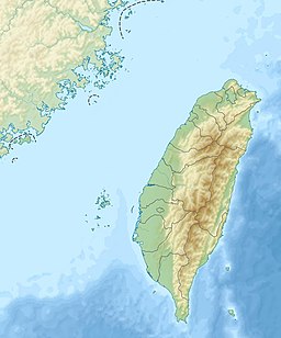
Yongheshan Reservoir
Appearance
| Yongheshan Reservoir | |
|---|---|
| 永和山水庫 Error {{native name checker}}: parameter value is malformed (help) | |
 | |
| Location | Sanwan, Miaoli County, Taiwan |
| Coordinates | 24°39′14.5″N 120°55′25.4″E / 24.654028°N 120.923722°E |
| Type | Reservoir |
| River sources | Beikenggou River, Nanzhuang River |
| Built | 1980-1984 |
| Surface area | 1.65 square kilometres (0.64 sq mi) |
| Max. depth | 89.5 metres (294 ft) |
| Water volume | 29,580,000 cubic metres (1.045×10⁹ cu ft) |
The Yongheshan Reservoir (Chinese: 永和山水庫; pinyin: Yǒnghéshān Shuǐkù) is a reservoir in Sanwan Township, Miaoli County, Taiwan.
History
The dam was constructed starting in July 1980 and completed in October 1984.[1]
Architecture
The water level of the reservoir stands at a height of 89.5 meters. The reservoir features automatic overflow side spillway.[1]
Function
The reservoir supplies water to public sectors for about 187,000 m3 per day.[2]
See also
References
- ^ a b "Yungheshan Reservoir". Miaoli Travel. Retrieved 24 January 2017.
- ^ "Profile on Taiwan Water Resources" (PDF). Water Resources Agency. 5 September 2006. p. 14. Retrieved 27 July 2018.
Wikimedia Commons has media related to Yongheshan Reservoir.

