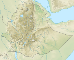
Lake Afrera
| Lake Afrera | |
|---|---|
 | |
| Location | Afar Depression |
| Coordinates | 13°17′N 40°55′E / 13.283°N 40.917°E |
| Basin countries | Eritrea, Ethiopia |
| Surface area | 100 km2 (39 sq mi) |
| Surface elevation | −102 m (−335 ft) |
| Islands | Franchetti Island |
Lake Afrera (in Italian Lake Giuletti) is a hypersaline lake in northern Ethiopia. Located in Administrative Zone 2 of the Afar Region, it is one of the lakes of the Danakil Depression. According to its entry in Lakenet, it has a surface area of 100 km2 (39 sq mi),[1] although another source states the area is 125 km2 (48 sq mi).[2] An unconfirmed report gives its depth as 160 m (525 ft); the lake is fed by underground streams.[2]
It is also known as Lake Giulietti, the name Raimondo Franchetti bequeathed it, after the Italian explorer Giuseppe Maria Giulietti who was slain by Afars southwest of the lake.[3] Another name for this body of water is Lake Egogi (or Egogi Bad), which is the name L. M. Nesbitt's Afar guide gave it when the Italian explorer became the first European to see it in 1928.[4]
The single island in Lake Afrera, Franchetti Island (also known as "Deset"), located in the southern part of the lake, is considered the lowest-lying island in the world.[5]
Unlike other saline lakes in Ethiopia (e.g., Lakes Abijatta, Shala, and Chitu), the pH of Lake Afrera is low and in the acidic range. Although little studied, a few species of fish are hosted by Lake Afrera, including two endemics: Danakilia franchettii (a cichlid) and Aphanius stiassnyae (syn. Lebias stiassnyae; a pupfish).[6]
Salt extraction

Rock salt has been mined at Lake Afrera, and the surrounding part of the Afar Depression, for centuries. Lt. Lefebvre recorded some of the hazards of mining salt from the Depression, which he heard from one of the miners himself:

He said that this lake often changes its shape and place, which he expressed in these terms: the lake moves. Often, he added, on going to a place which the evening before was quite solid, you suddenly break through, and disappear in the abyss. But what is more frightful is the overflow of the waters: sometimes the lake rises like a mountain, and falls again into the plain like a deluge; entire caravans, men and beasts are engulphed. There are, however, precursory signs, of which mounted men only can take advantage, by flying at the utmost speed of the animals; occasionally some of them have thus escaped, and it is from them these terrible details are procured.[7]
More recently, the Ethiopian Mineral Resources Development Enterprise has established the existence of 290 million tons of salt at Lake Afrera alone. Some local companies used to produce salt from the lake by pumping the brine into artificial ponds for evaporation and subsequent precipitation.[8]
Following the 2011 eruption of Nabro, the lake is contaminated with sulfuric acid, making the salt inedible.[9]
The highly saline Lake Afrera fills a topographic depression in the northern AfarRift at the offset between the southern tip of the Erta Ale volcanic ridge and thenorthern tips of the Alaita and Tat Ali ridges. Bathymetric profiles revealed≈80 mdeep canyon (minus≈190 m below sea level) parallel to NNW normal faultsexposed at the NE shore of the lake.[10]
See also
Notes
- ^ Lake profile: Afrera ye'ch'ew (accessed 27 April 2007)
- ^ a b Robert Mepham, R. H. Hughes, and J. S. Hughes, A directory of African wetlands, (Cambridge: IUCN, UNEP and WCMC, 1992), p. 168
- ^ Jon Kalb, Adventures in the Bone Trade (New York: Copernicus Books, 2001), p. 72
- ^ Nesbitt, Hell-Hole of Creation: The Exploration of Abyssinian Danakil (New York: Alfred A. Knopf, 1935), p. 337
- ^ Philip Briggs, Ethiopia: The Bradt Travel Guide, 5th edition (Chalfont St Peters: Bradt, 2009), p. 314
- ^ "527: Western Red Sea Drainages" Archived 2011-10-05 at the Wayback Machine, Freshwater ecosystems of the world website (accessed 11 November 2009)
- ^ Henry James, Routes in Abyssinia; Presented to the house of Commons, in pursuance of their Address dated November 26, 1867 (London, 1867), p. 200
- ^ Current Exploration and Mining Archived 2007-04-22 at archive.today, Geological Survey of Ethiopia Web Page (accessed 26 January 2009)
- ^ Mesfin, Mahlet (June 12, 2011). "Eritrean Volcano Erupts Economic Mayhem for Ethiopia". Addis Fortune. Archived from the original on June 23, 2011.
- ^ Bonatti, Enrico; Gasperini, Elia; Vigliotti, Luigi; Lupi, Luca; Vaselli, Orlando; Polonia, Alina; Gasperini, Luca (May 2017). "Lake Afrera, a structural depression in the Northern Afar Rift (Red Sea)". Heliyon. 3 (5): e00301. doi:10.1016/j.heliyon.2017.e00301. ISSN 2405-8440. PMC 5443967. PMID 28560355.

