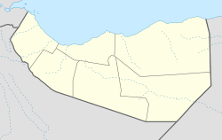
Ruguda
Appearance
Coordinates: Template:Xb_type:city 10°51′0″N 46°50′54″E / 10.85000°N 46.84833°E
Ruguda
Ruguuda | |
|---|---|
Town | |
| Coordinates: Template:Xb_type:city 10°51′0″N 46°50′54″E / 10.85000°N 46.84833°E | |
| Country | |
| Region | Sanaag |
| District | El Afweyn District |
| Time zone | UTC+3 (EAT) |
Ruguda (Somali: Ruguuda) is a historic coastal town located in the Sanaag region of Somaliland, near Heis.[1]
History
Ruguda was a well known landmark to navigators and legendary Arab explorer Ahmad ibn Mājid wrote of Ruguda and a few other many notable landmarks and ports of the northern Somali coast, including Berbera, the Sa'ad ad-Din islands aka the Zeila Archipelago near Zeila, Siyara, Maydh, Alula, El-Sheikh, Heis and El-Darad.[2]
Demographics
Ruguda is populated by the Sanbuur sub-division of the Habr Je'lo Isaaq.[3][4]
References
- ^ http://so.geoview.info/ruguda,1404225795n
- ^ "Ibn Majid". Medieval Science, Technology, and Medicine: An Encyclopedia. Routledge. 2005. ISBN 978-1-135-45932-1.
- ^ http://barkulannews.com/articles/14345/SHIRKII-BEESHA-IBRAAHIN-SHEEKH-ISAXAAQ-SANBUUR-OO-LA-SOO-GUNAANADAY-IYO-WIXII-KA-SOO-BAXAYE-SAWIRO
- ^ "Ceerigaabo:-Beesha Sanbuur Sheikh Isxaaq Qaybta Degta G/Sanaag Oo Caleemo Saaray Suldaan Faah Faahinta Warbixintan Hoos Ka Eeg | Waxsansheeg News". waxsansheeg.com. Retrieved 2021-01-29.

