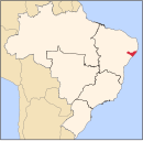
Anadia, Alagoas
Appearance
09°41′04″S 36°18′15″W / 9.68444°S 36.30417°W
You can help expand this article with text translated from the corresponding article in Portuguese. (August 2012) Click [show] for important translation instructions.
|
Anadia | |
|---|---|
| Coordinates: 9°41′4″S 36°18′15″W / 9.68444°S 36.30417°W | |
| Country | |
| State | Alagoas |
| Government | |
| • Prefect | José Augusto Rocha Souza |
| Area | |
| • Total | 73.155 sq mi (189.471 km2) |
| Elevation | 502 ft (153 m) |
| Population (2020) | |
| • Total | 17,526 |
| Time zone | UTC-3 |
Anadia is a municipality located in the Brazilian state of Alagoas. Its population is 17,526 (2020)[1] and its area is 189 km².[2]
References
- ^ IBGE 2020
- ^ IBGE - "Archived copy". Archived from the original on 11 June 2008. Retrieved 2008-06-11.
{{cite web}}: CS1 maint: archived copy as title (link)


