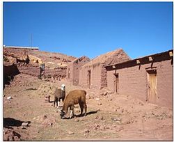
San Pablo de Lípez
Appearance
You can help expand this article with text translated from the corresponding article in German. (February 2010) Click [show] for important translation instructions.
|
San Pablo de Lípez | |
|---|---|
Town | |
 | |
 | |
| Country | |
| Department | Potosí Department |
| Province | Sur Lípez Province |
| Municipality | San Pablo de Lípez Municipality |
| Population (2001) | |
| • Total | 221 |
| Time zone | UTC-4 (BOT) |
San Pablo de Lípez is a small town in the Potosí Department of Bolivia. It is the seat of the Sur Lípez Province and of the San Pablo de Lípez Municipality.


