
Kunes, Finnmark
Kunes
Gussanjárga | |
|---|---|
Village | |
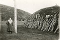
 View of the village | |
 Kunes Location in Finnmark  Kunes Kunes (Norway) | |
| Coordinates: 70°21′02″N 26°31′21″E / 70.35056°N 26.52250°E | |
| Country | Norway |
| Region | Northern Norway |
| County | Troms og Finnmark |
| District | Øst-Finnmark |
| Municipality | Lebesby |
| Elevation | 16 m (52 ft) |
| Time zone | UTC+01:00 (CET) |
| • Summer (DST) | UTC+02:00 (CEST) |
| Post Code | 9742 Kunes |
Kunes (Northern Sami: Gussanjárga) is a village in Lebesby Municipality in Troms og Finnmark county, Norway. The small village is located along Norwegian County Road 98, on the shore of the innermost arm of the Laksefjorden. Kunes Chapel is located in this village.
-
 The structure where the telephone switchboard, Kunes telefonsentral was located in 1909.

References
- ^ "Kunes, Lebesby" (in Norwegian). yr.no. Retrieved 2013-02-18.
This article about a location in Finnmark is a stub. You can help Wikipedia by expanding it. |