
Nordhalben
Nordhalben | |
|---|---|
 Nordhalben seen from the north | |
 Coat of arms | |
Location of Nordhalben within Kronach district 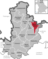 | |
 Nordhalben  Nordhalben | |
| Coordinates: 50°22′25″N 11°30′40″E / 50.37361°N 11.51111°E | |
| Country | Germany |
| State | Bavaria |
| Admin. region | Oberfranken |
| District | Kronach |
| Subdivisions | 8 Ortsteile |
| Government | |
| • Mayor (2020–26) | Michael Pöhnlein[1] (FW) |
| Area | |
| • Total | 21.92 km2 (8.46 sq mi) |
| Elevation | 586 m (1,923 ft) |
| Population (2023-12-31)[2] | |
| • Total | 1,626 |
| • Density | 74/km2 (190/sq mi) |
| Time zone | UTC+01:00 (CET) |
| • Summer (DST) | UTC+02:00 (CEST) |
| Postal codes | 96365 |
| Dialling codes | 09267 |
| Vehicle registration | KC |
| Website | www.nordhalben.de |
Nordhalben is a municipality in the district of Kronach in Bavaria in Germany.
References
[edit]- ^ Liste der ersten Bürgermeister/Oberbürgermeister in kreisangehörigen Gemeinden, Bayerisches Landesamt für Statistik, 15 July 2021.
- ^ Genesis Online-Datenbank des Bayerischen Landesamtes für Statistik Tabelle 12411-003r Fortschreibung des Bevölkerungsstandes: Gemeinden, Stichtag (Einwohnerzahlen auf Grundlage des Zensus 2011).
Towns and municipalities in Kronach (district) | ||
|---|---|---|
 | ||
| International | |
|---|---|
| National | |
This Kronach district location article is a stub. You can help Wikipedia by expanding it. |