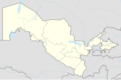
Vodnik, Uzbekistan
Appearance
Vodnik | |
|---|---|
urban-type settlement | |
| Coordinates: 42°25′59″N 59°32′24″E / 42.43306°N 59.54000°E | |
| Country | |
| Autonomous Republic | Karakalpakstan |
| District | Xoʻjayli District |
| Population (2016) | |
• Total | 5,900 |
| Time zone | UTC+5 (UZT) |
Vodnik (Template:Lang-uz, Template:Lang-ru) is an urban-type settlement of Xoʻjayli District in Karakalpakstan in Uzbekistan.[1] Its population was 5,176 people in 1989,[2] and 5,900 in 2016.[3]
References
- ^ "Classification system of territorial units of the Republic of Uzbekistan" (in Uzbek and Russian). The State Committee of the Republic of Uzbekistan on statistics. July 2020.
- ^ Population census-1989
- ^ Soliyev, A.S. Shaharlar geografiyasi [Geography of cities] (PDF) (in Uzbek). p. 147.


