Jump to content

Col des Rangiers

Coordinates: 47°23′5.53″N 7°13′8.6″E / 47.3848694°N 7.219056°E / 47.3848694; 7.219056
From Wikipedia, the free encyclopedia

This is the current revision of this page, as edited by Shinkolobwe (talk | contribs) at 16:48, 27 February 2022 (Adding local short description: "Mountain pass (Jura, Switzerland)", overriding Wikidata description "mountain pass" (Shortdesc helper)). The present address (URL) is a permanent link to this version.

(diff) ← Previous revision | Latest revision (diff) | Newer revision → (diff)
Col des Rangiers
Col des Rangiers
Elevation856 m (2,808 ft)
LocationSwitzerland
RangeJura Mountains
Coordinates47°23′5.53″N 7°13′8.6″E / 47.3848694°N 7.219056°E / 47.3848694; 7.219056

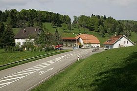
Col des Rangiers (el. 856 m.) is a mountain pass in the canton of Jura in Switzerland.

It connects Courgenay and Develier.