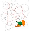
N'Douci
Appearance
N'Douci
Ndouci | |
|---|---|
Town and sub-prefecture | |
| Coordinates: 5°52′N 4°45′W / 5.867°N 4.750°W | |
| Country | |
| District | Lagunes |
| Region | Agnéby-Tiassa |
| Department | Tiassalé |
| Area | |
| • Total | 302 km2 (117 sq mi) |
| Population (2021 census)[2] | |
| • Total | 97,194 |
| • Density | 320/km2 (830/sq mi) |
| • Town | 27,112[1] |
| (2014 census) | |
| Time zone | UTC+0 (GMT) |
N'Douci (also spelled Ndouci) is a town in southern Ivory Coast. It is a sub-prefecture of Tiassalé Department in Agnéby-Tiassa Region, Lagunes District. N'Douci was a commune until March 2012, when it became one of 1126 communes nationwide that were abolished.[3] In 2021, the population of the sub-prefecture of N'Douci was 97,194.[2]
Villages
[edit]The 12 villages of the sub-prefecture of N'Douci and their population in 2014 are:[4]
- Abevé/Abeyé (2 119)
- Akoudjé (635)
- Attiguéhi (7 396)
- Batéra (2 799)
- Bodo (4 304)
- Boussoukro (1 736)
- Kanga-Nianzé (3 381)
- Kodimasso (1 373)
- N'douci (27 112)
- Niamazra (3 677)
- Nianda (1 608)
- Offa (850)
Notes
[edit]- ^ Citypopulation.de Population of cities & localities in Ivory Coast
- ^ a b Citypopulation.de Population of the regions and sub-prefectures of Ivory Coast
- ^ "Le gouvernement ivoirien supprime 1126 communes, et maintient 197 pour renforcer sa politique de décentralisation en cours", news.abidjan.net, 7 March 2012.
- ^ Citypopulation.de Population of the localities in the sub-prefecture of Ndouci


