
Rimberg
Rimberg | |
|---|---|
 | |
Location of Rimberg  | |
 Rimberg  Rimberg | |
| Coordinates: 51°13′3″N 8°20′57″E / 51.21750°N 8.34917°E | |
| Country | Germany |
| State | North Rhine-Westphalia |
| Admin. region | Arnsberg |
| District | Hochsauerlandkreis |
| Town | Schmallenberg |
| Population (2021-12-31) | |
| • Total | 4 |
| Time zone | UTC+01:00 (CET) |
| • Summer (DST) | UTC+02:00 (CEST) |
Rimberg is a locality in the municipality Schmallenberg in the district Hochsauerlandkreis in North Rhine-Westphalia, Germany.
The hamlet has 4 inhabitants[1] and lies in the north of the municipality of Schmallenberg at a height of around 610 m. Rimberg borders on the villages of Sonderhof and Bad Fredeburg.
Gallery
[edit]-
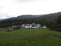 Hotel Rimberg
 -
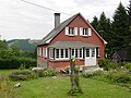
 House No. 2
 -
 House No. 3


References
[edit]- ^ Schmallenberg.de: Inhabitants (in German)
| Authority control databases: National |
|---|
This Hochsauerlandkreis location article is a stub. You can help Wikipedia by expanding it. |