Congerstone
| Congerstone | |
|---|---|
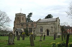
 St Mary's Parish Church | |
Location within Leicestershire | |
| OS grid reference | SK3605 |
| Civil parish | |
| District | |
| Shire county | |
| Region | |
| Country | England |
| Sovereign state | United Kingdom |
| Post town | Nuneaton |
| Postcode district | CV13 |
| Police | Leicestershire |
| Fire | Leicestershire |
| Ambulance | East Midlands |
| UK Parliament | |
Congerstone (/ˈkʌndʒəstən/) is a village and former civil parish, now in the parish of Shackerstone, in the Hinckley and Bosworth district, in Leicestershire, England.[1] It is three miles north west of Market Bosworth, of which it was historically a daughter parish. It is near the Ashby-de-la-Zouch Canal and the A444 road. In 1931 the parish had a population of 209.[2]
The Grade II* listed parish church of St Mary the Virgin dates back to 1179, although the current building is largely from the 16th century and was remodelled in the 19th century. [3] The patron of the church was formerly the Curzon family of Earl Howe who also helped fund the village school. [4] The church includes the tomb of Georgiana, Countess Howe, first wife of Richard Curzon, 4th Earl Howe, with a monument by Sir George Frampton. [5]
The village has one school, Congerstone Primary School, on Shackerstone Road.
History
The village's name derives from the Old English cyning-tūn meaning 'farm/settlement of a king'.[6]
On 1 April 1935 the parish was abolished and merged with Shackerstone.[7]
References
- ^ OS Explorer Map 232 : Nuneaton & Tamworth: (1:25 000) :ISBN 0 319 46404 0
- ^ "Population statistics Congerstone AP/CP through time". A Vision of Britain through Time. Retrieved 26 December 2022.
- ^ "Church of St Mary the Virgin A Grade II* Listed Building in Congerstone, Leicestershire". British Listed Buildings. Archived from the original on 15 June 2020. Retrieved 15 June 2020.
- ^ "Compton-Dundon - Congresbury Pages 675-678 A Topographical Dictionary of England. Originally published by S Lewis, London, 1848". British History Online. Archived from the original on 15 June 2020. Retrieved 15 June 2020.
- ^ "About us - Congerstone: St Mary the Virgin". A Church Near You. Archived from the original on 15 June 2020. Retrieved 15 June 2020.
- ^ "Key to English Place-names". kepn.nottingham.ac.uk. Archived from the original on 10 August 2021. Retrieved 19 August 2021.
- ^ "Relationships and changes Congerstone AP/CP through time". A Vision of Britain through Time. Retrieved 26 December 2022.

