Pangua
Appearance
Pangua | |
|---|---|
Minor local entity | |
 | |
| Coordinates: 42°44′19″N 2°49′38″W / 42.73861°N 2.82722°W[1] | |
| Country | |
| Autonomous community | |
| Province | Province of Burgos |
| Municipality | Condado de Treviño |
| Elevation | 526 m (1,726 ft) |
| Population | |
• Total | 11 |
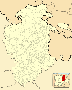
Pangua is a hamlet and minor local entity located in the municipality of Condado de Treviño, in Burgos province, Castile and León, Spain. As of 2020, it has a population of 11.[2]
Geography
[edit]Pangua is located 93km east-northeast of Burgos.
References
[edit]- ^ Mapa de Pangua, Condado de Treviño, Provincia de Burgos, Castilla y León
- ^ "Nomenclátor: Población del Padrón Continuo por Unidad Poblacional" (in Spanish). Instituto Nacional de Estadística (España). Retrieved 25 September 2021.


