Corbetti Caldera
Appearance
| Corbetti Caldera | |
|---|---|
| Highest point | |
| Elevation | 2,320 m (7,610 ft)[1] |
| Coordinates | 07°10′26″N 38°27′29″E / 7.17389°N 38.45806°E |
| Geography | |
| Location | Oromia Region, near Hawassa |
| Geology | |
| Mountain type | Caldera |
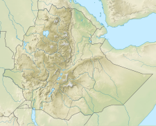
The Corbetti Caldera is an actively deforming volcano in the Main Ethiopian Rift.[2] It is the site of the Corbetti Geothermal Power Station. The Corbetti Caldera is 15 km (9.3 mi) across and overlaps an older (pleistocene), 30 by 40 km (19 by 25 mi) caldera called Awasa, which is considered the same volcanic system. The Corbetti Caldera contains the central cone called Urji and a large obsidian dome called Chebbi.[1] The Awasa Caldera contains Lake Hawassa and the town of Awasa, the Corbetti caldera contains half of the Senkelle Swayne's Hartebeest Sanctuary.
References
- ^ a b "Corbetti Caldera". Global Volcanism Program. Smithsonian Institution. Retrieved 2022-09-25.
- ^ Lavayssière, Aude; Greenfield, Tim; Keir, Derek; Ayele, Atalay; Kendall, J-Michael (1 September 2019). "Local seismicity near the actively deforming Corbetti volcano in the Main Ethiopian Rift". Journal of Volcanology and Geothermal Research. 381: 227–237. doi:10.1016/j.jvolgeores.2019.06.008. S2CID 197559622. Retrieved September 25, 2022.

