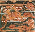
Yoshimine-dera
Appearance
| Yoshimine-dera 善峯寺 | |
|---|---|
 The main gate (Sanmon) at Yoshimine-dera | |
| Religion | |
| Affiliation | Tendai |
| Location | |
| Location | 1372 Ōharano Oshiochō Nishikyō-ku, Kyoto, Kyoto Prefecture |
| Country | Japan |
| Architecture | |
| Founder | Gensan |
| Completed | 1029 |
| Website | |
| http://www.yoshiminedera.com/ | |
Yoshimine-dera (善峯寺) is a temple of the Tendai school of Buddhism in the western ward of Nishikyō-ku, in Kyoto.[1] It is built on the western hills (Nishiyama) overlooking the city.
It was founded in 1029 by Gensan.[2]
The main image is a statue of thousand-armed Kannon.[3] Notable features include the "Gliding Dragon" pine tree (Yōryu no matsu, a natural monument), which was trained to grow horizontally and was once over 50 meters long,[4][5] and a Tahōtō two-story pagoda (an Important Cultural Asset).[3]
Yoshimine-dera is the twentieth temple on the Kansai Kannon Pilgrimage.[1]
References
[edit]- ^ a b "善峯寺" [Yoshimine-dera]. Dijitaru Daijisen (in Japanese). Tokyo: Shogakukan. 2012. OCLC 56431036. Archived from the original on August 25, 2007. Retrieved 2012-12-03.
- ^ "善峯寺" [Yoshimine-dera]. Kokushi Daijiten (in Japanese). Tokyo: Shogakukan. 2012. OCLC 683276033. Archived from the original on August 25, 2007. Retrieved 2012-12-03.
- ^ a b Yoshimine-dera Archived February 5, 2011, at the Wayback Machine on kyotokanko.co.jp
- ^ Marc Treib and Ron Herman, A Guide to the Gardens of Kyoto (Revised Edition), Kodansha International, 2003, ISBN 9784770029539, page 118
- ^ "善峯寺" [Yoshimine-dera]. Nihon Kokugo Daijiten (in Japanese). Tokyo: Shogakukan. 2012. OCLC 56431036. Archived from the original on August 25, 2007. Retrieved 2012-08-02.
Wikimedia Commons has media related to Yoshimine-dera.


